
PORTLAND, Maine — A powerful rain and windstorm will move into Maine late Sunday into Monday. This will be a 24-hour or less storm for most of the state. Flooding and power outages are possible as we get into Monday morning especially. Let’s discuss the new details:

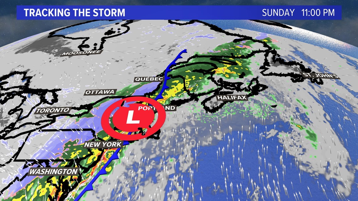
Low pressure will develop along a strong cold front slicing through the Pine Tree State early Monday morning.

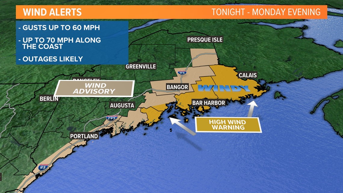
High wind warnings are up for Hancock, Washington, Knox, and coastal Waldo Counties where the highest probability of damaging wind is likely due to a low-level jet stream transporting wind energy down to the ground level. Think of if planes in the sky were flying very low to the ground and you felt some of those wind gusts. The heavy rain will help to send that wind to the ground.
A large chunk of the state is under a wind advisory due to the potential for gusts exceeding 50 to 60 MPH early on Monday morning, if the cold front should track a few miles west. That's for everyone in the lighter tan color.

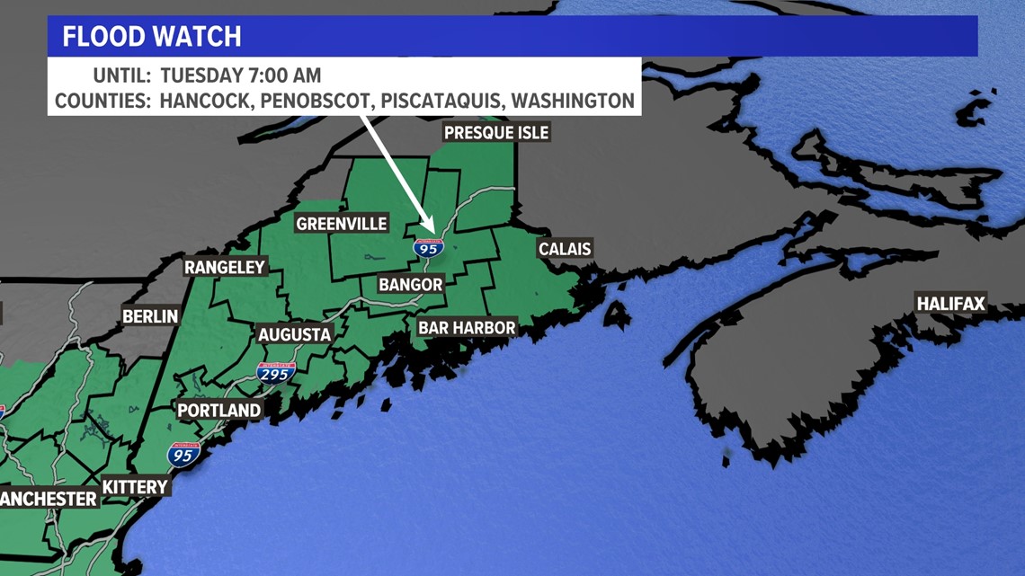
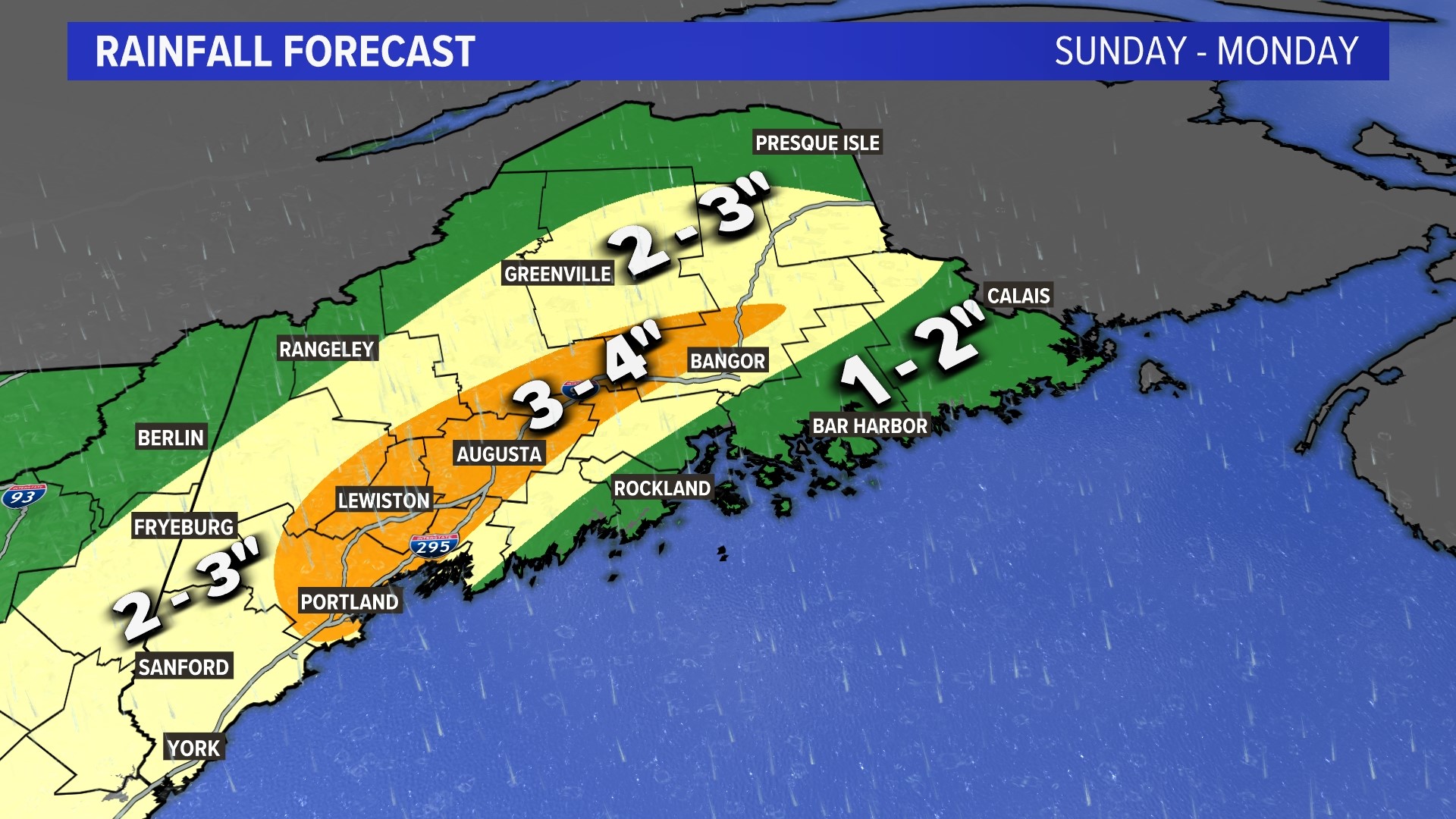
A flood watch covers nearly all of Maine with a lot of moisture available to be falling from the sky heavily Sunday night into Monday morning. Rainfall rates of more than 1 inch per hour and totals near 4 inches in the Kennebec River Valley are possible. The heavy rain with high dewpoints will cause rapid snowmelt on streams and creeks. I also expect the rivers to rise on Monday during the runoff.

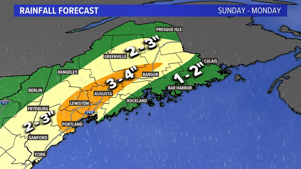
Here is my rainfall map for the state where you can see the heaviest amounts.

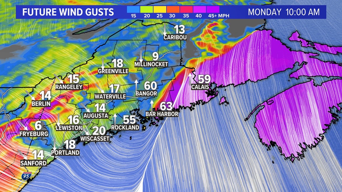
Wind gusts from the computer models have shifted to being the worst over Downeast Maine if the front stays east.

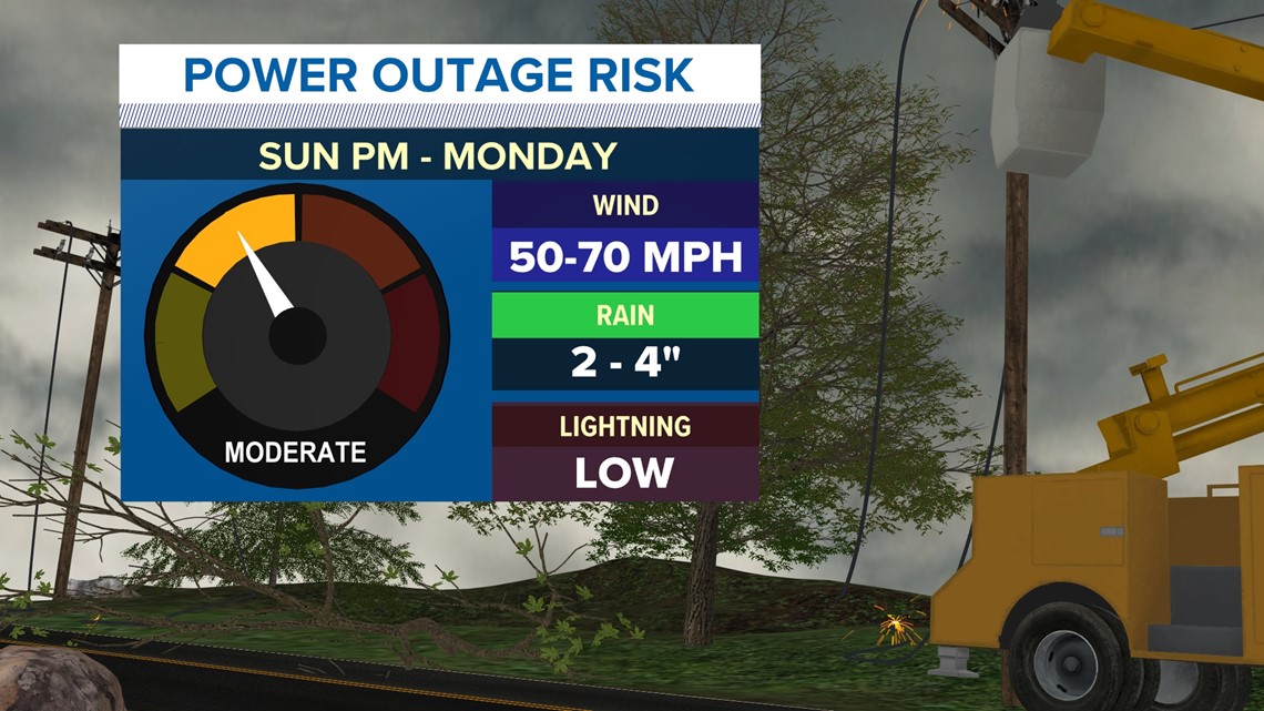
I still have a power outage forecast for moderate thanks to the amount of wind energy available.

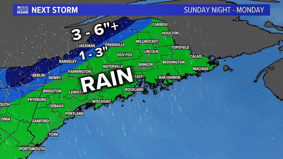
I’m not expecting much snow from this storm, but the high peaks of the western mountains and the boundary plateau have the best shot for accumulation.

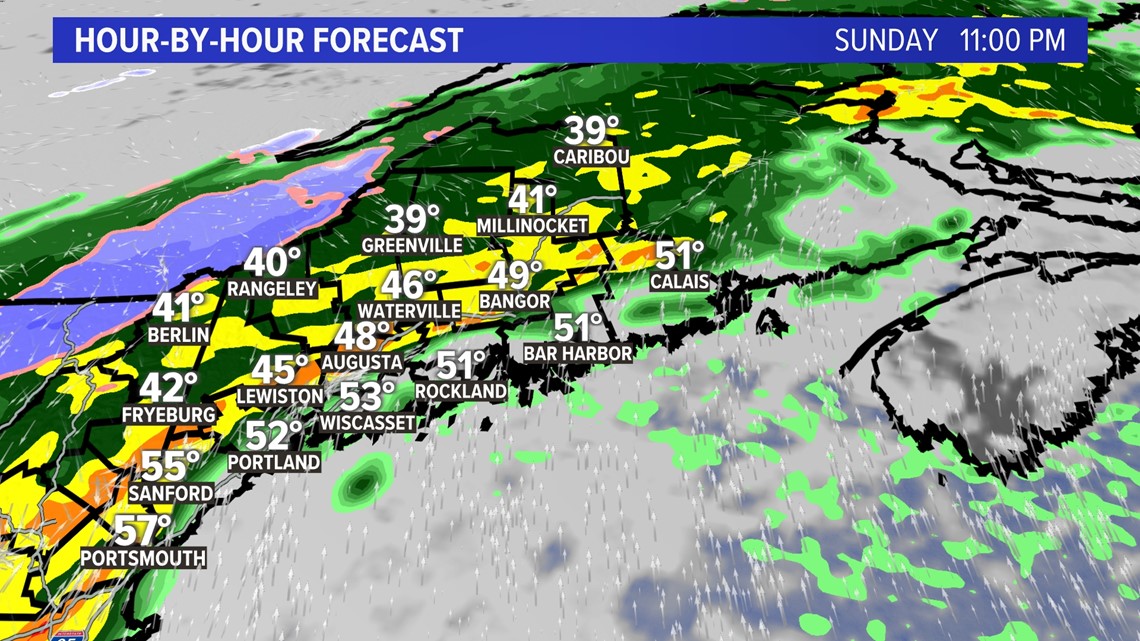
Here is the timeline for the storm as the first batch of heavy rain arrives Sunday night.

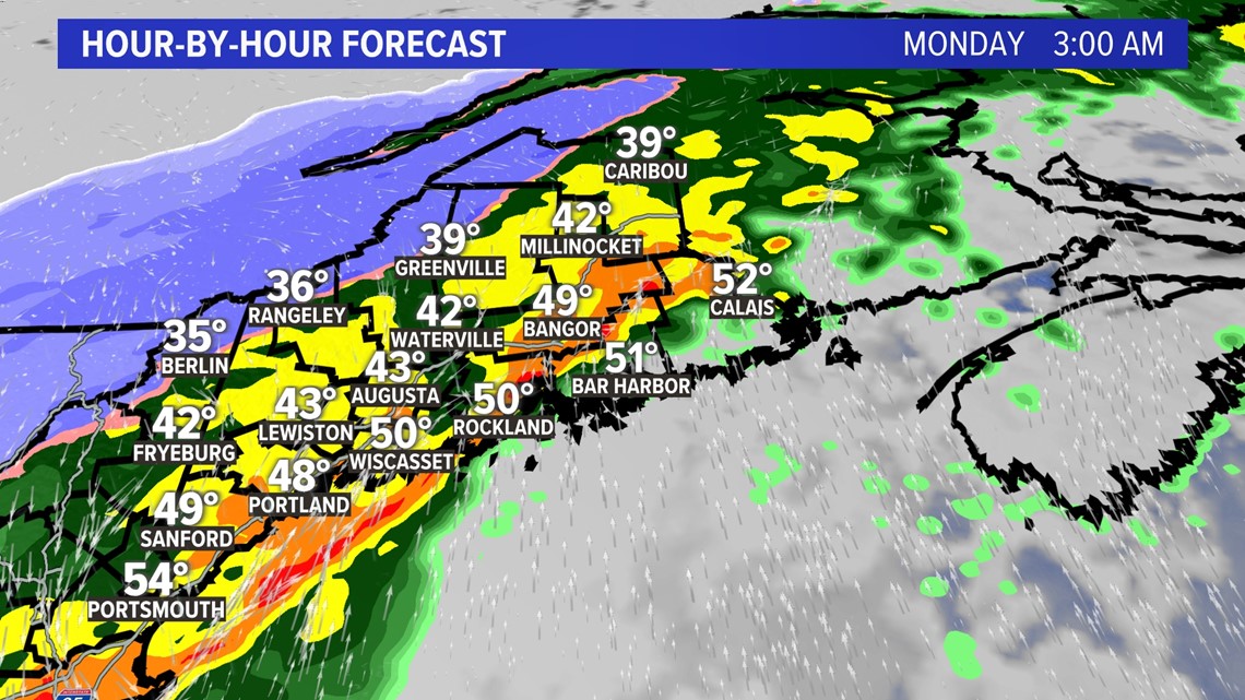
The rain continues Monday morning and will be very heavy.

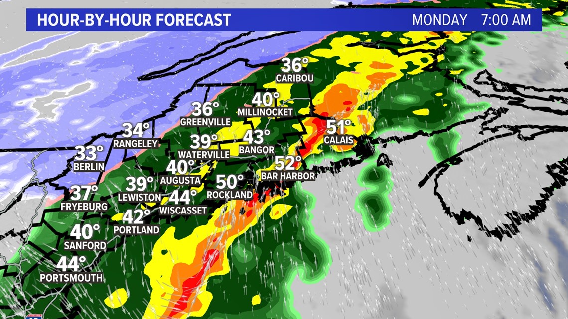
Still seeing heavy rain at 7 a.m.

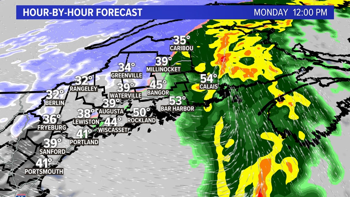
The storm is done for most of Maine by Noon except for northern and Downeast.

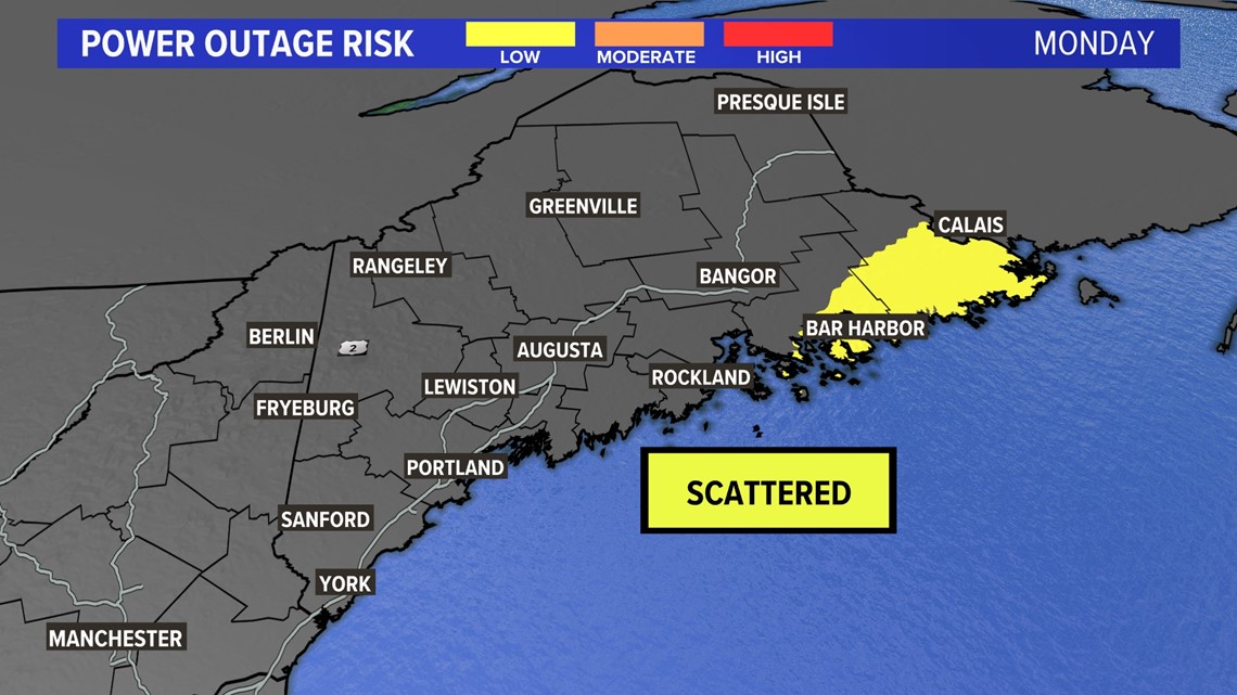
The last check of the outage risk map shows Washington County in the bullseye for scattered outages.
I’ll have more updates all weekend long as I track the storm.


Follow along for more weather blogs and pizza discussions.