MAINE, USA — A Nor'easter pummeled New England this weekend and brought heavy snow to some, while others received almost no snowfall.
Temperatures with this system were pretty warm for snowfall overall. Most in the state were right at or below freezing as the storm passed through. This made for a slushy and pasty snow.
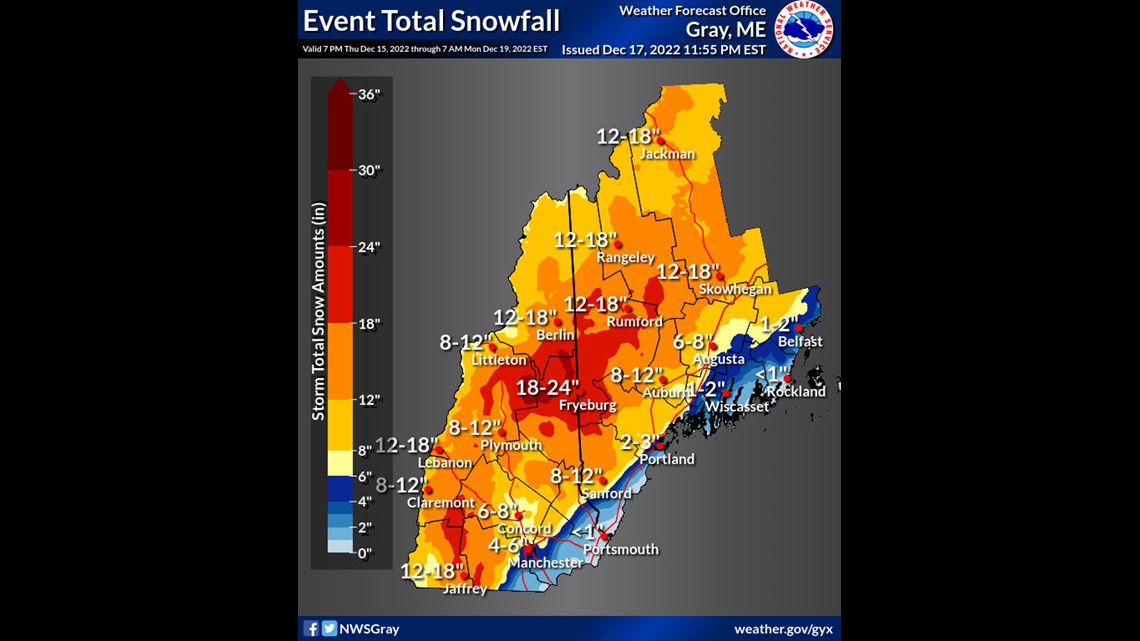
Areas along the coast stayed warmer, which kept the precipitation as rainfall for some areas, including Bar Harbor. Portland was able to freeze and get snow totals around two to three inches", but that was a very wet, slushy snow that did not hold together very well.
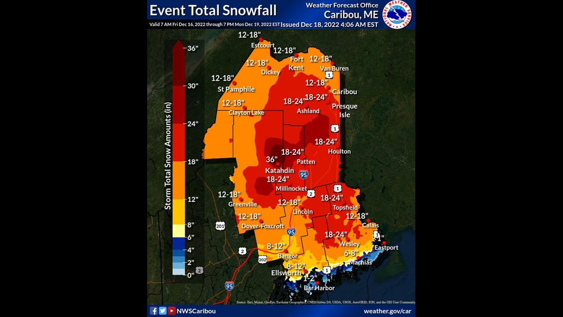
The track and temperatures also allowed others to get much more snowfall. Most of the state got at least a foot of snowfall, with the highest totals near Katahdin.
Here are the official snow totals from the National Weather Service in Gray, ME.


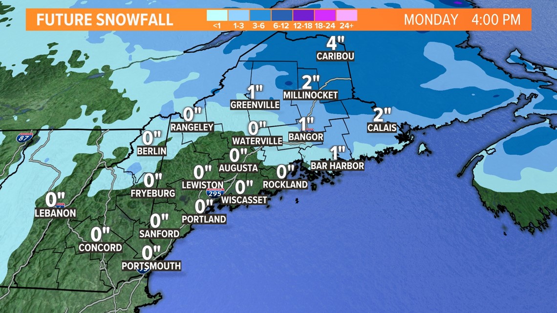
More snow will continue to fall through Sunday and into Monday morning across eastern Maine. We are expecting to see another one to four inches of snow, depending on your location.


The heaviest of the snow will be concentrated the further north and east you live. Some could get up to six to eight inches of additional snowfall.
The National Weather Service office in Caribou has released its snow totals for the entire event. This includes reports from Saturday's snowfall, in addition to future snowfall on Sunday and Monday.


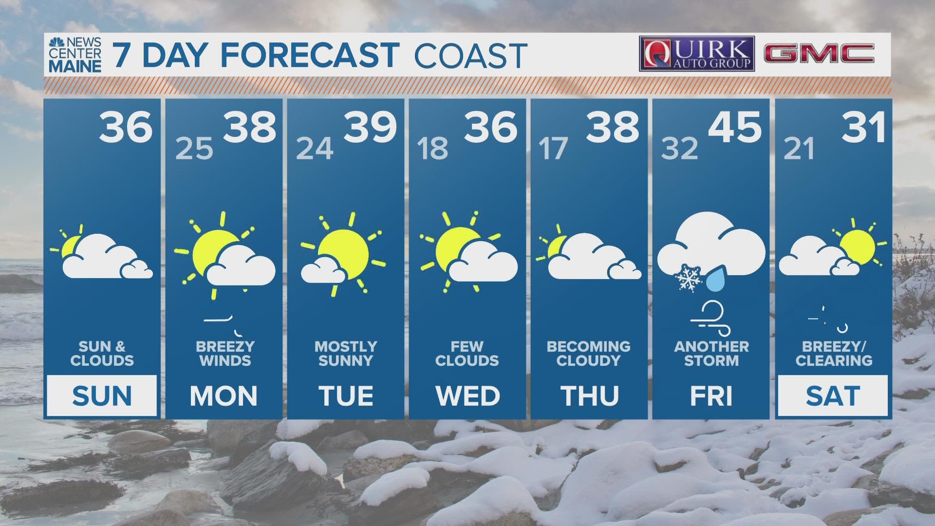
Will this all melt immediately? No. Temperatures are staying just above freezing for the majority of the week ahead, which will allow some snow to melt, but that won't eat through 24 inches of snow that quickly.
This pattern is allowing for a lot of black ice around the state, so take it easy on the sidewalks and roads!
Stay safe, and enjoy the slopes!
- Aaron

