MAINE, USA — Mid-January is upon us, and the snow drought just keeps getting worse for Maine.
A quick glance at the current snow depth map shows only the western mountains and northern Maine have significant snow on the ground.

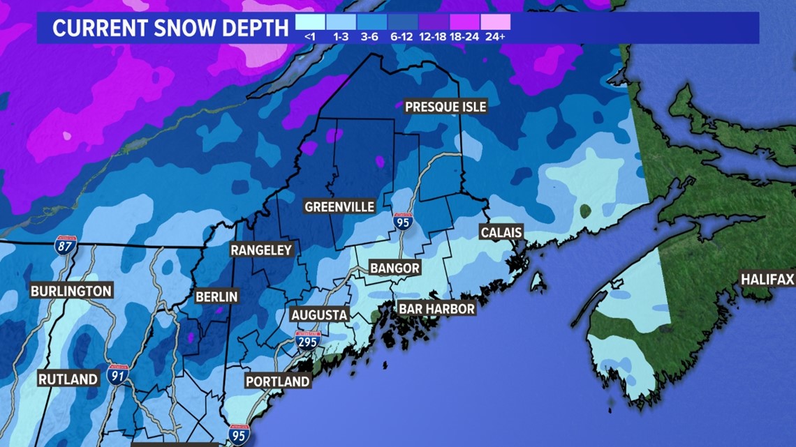
But that's where you'd expect the most snow to be in Maine, as the average annual snowfall is more than 100 inches in those locations to the north and west.

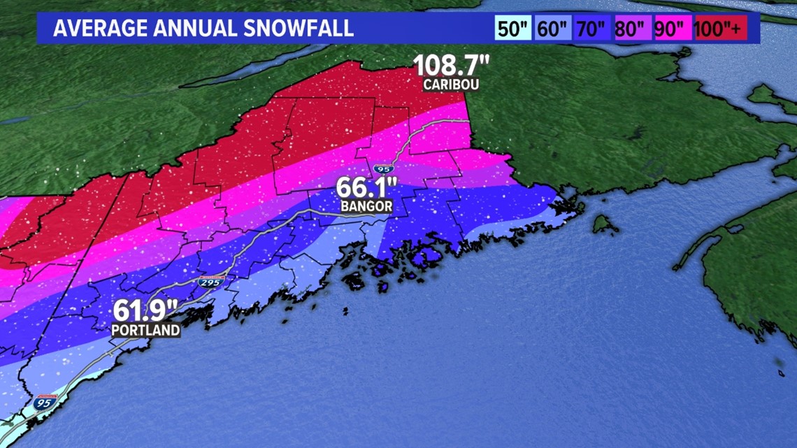
Let's dig into the details and see where parts of the state stack up and just how far behind the eight ball, we are ...
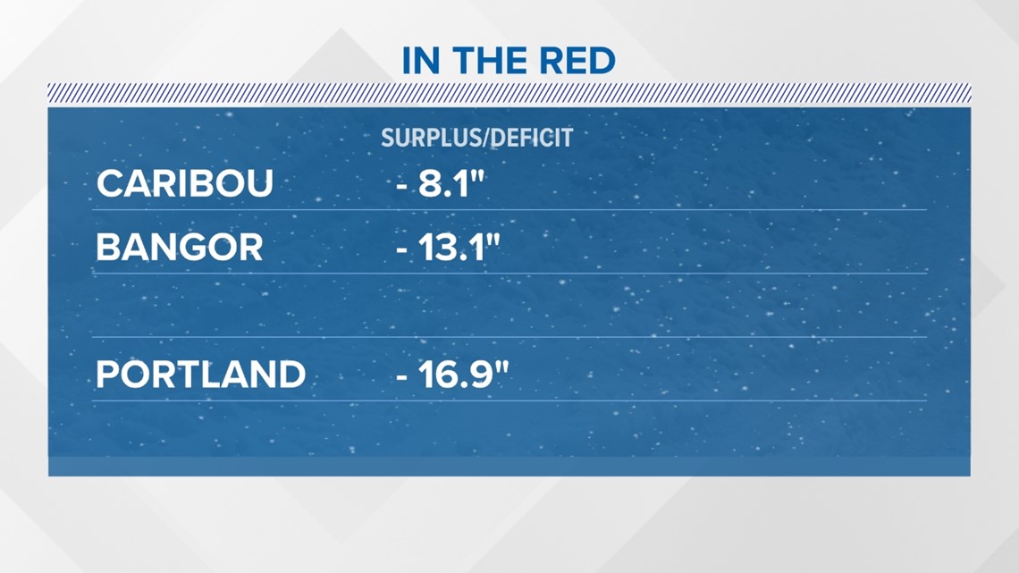
Caribou is reporting 38.4", Bangor sits at 13.2", and Portland is close to 7".
Typically by now, Caribou is at 46.5", Bangor at 26.3", and Portland close to 2 feet at 23.7".

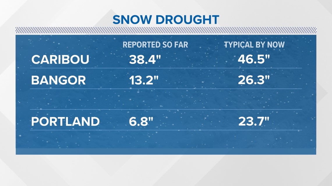
The coastline is seeing the most significant contrast in a snowfall deficit with Portland nearly a foot and a half in the red. Bangor is not far behind with less than half its typical snowfall amounts by now.
This week's storm will put a dent in Caribou's deficit and might even take it off the board by next week.

It remains to be seen if this trend will continue, but the medium-range pattern does not favor significant snowstorms at this time.
Next time I will dig into the difference between a snow drought out to sea and a snow drought inland runner pattern (like we've been seeing so far this season).
-- Jason

