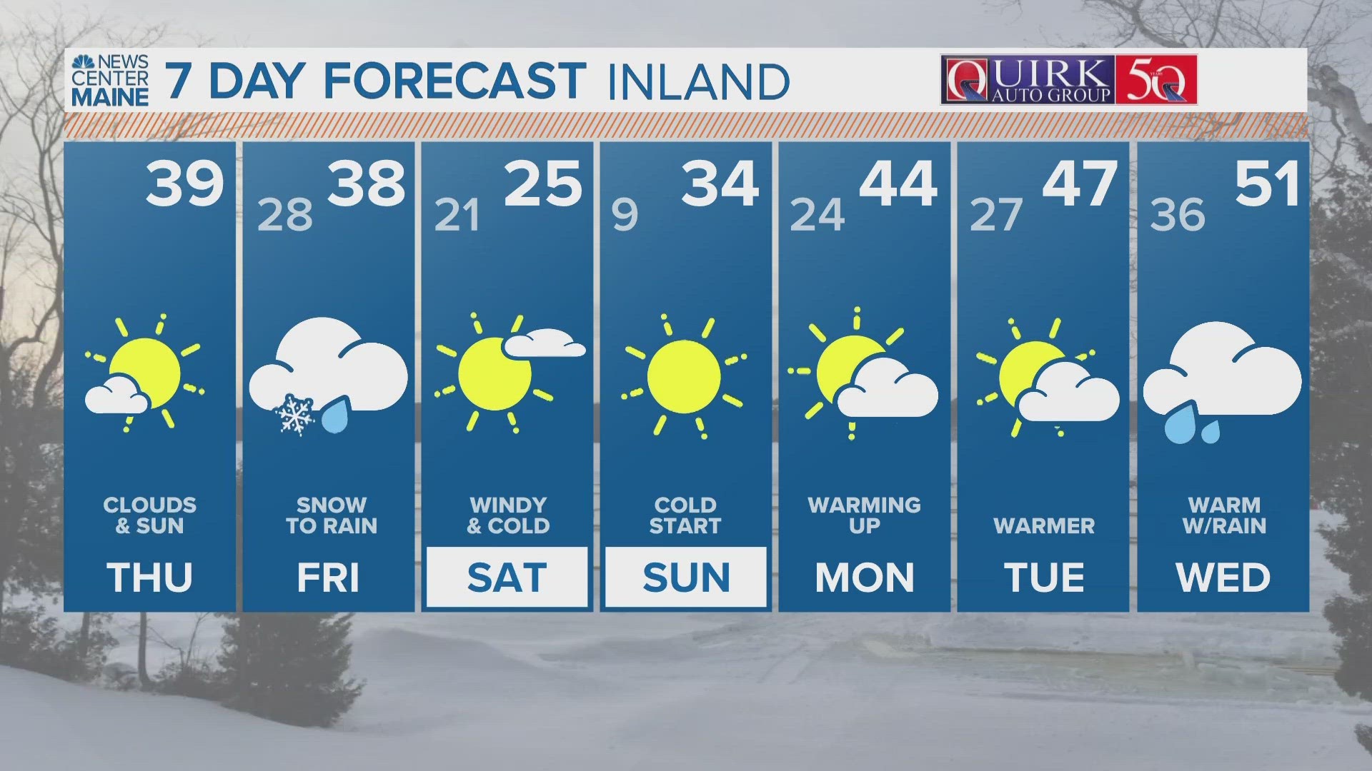
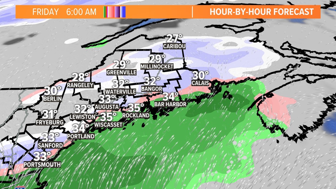
PORTLAND, Maine — This winter is going down in the record books as one of the warmest, if not the warmest on record in Maine. But we’ll get to that in March. For now, there’s a weak winter storm coming overnight into Friday. The storm, if we can call it that, will bring snow to start before a changeover to rain during the morning. This will not be a high impact event, but it will make for a messy morning commute, especially the farther you get away from the coast.

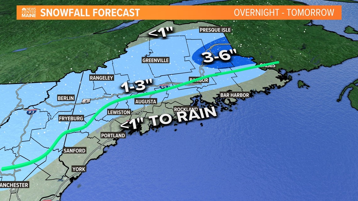
Look for less than 1 inch of snow along the coastline from this weather-maker, with snow changing to rain from a line west of York County heading north of Lewiston, Augusta and Bangor/Calais.

I can see more than 3 inches for Danforth, Houlton, and Lincoln.

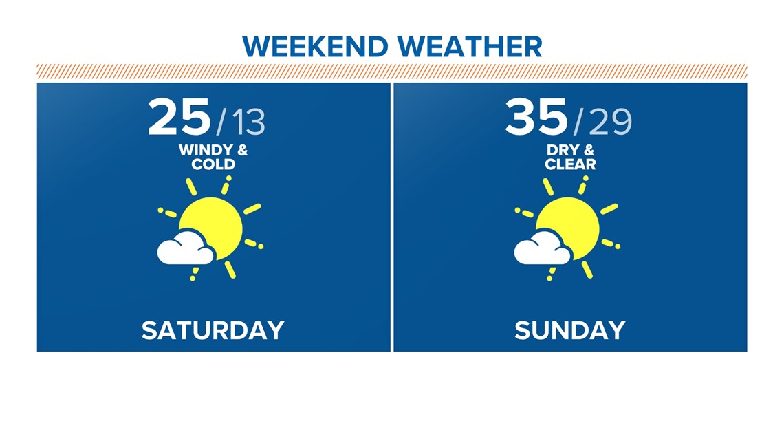
A series of cold fronts move in to kick off the weekend, so it will be quite chilly with a few snow squalls.
We start off Sunday morning very cold with single digits and teens without the wind chills.

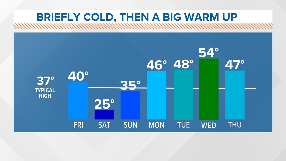
Things start to warm up rather quickly next week with 40s and 50s back in the forecast.

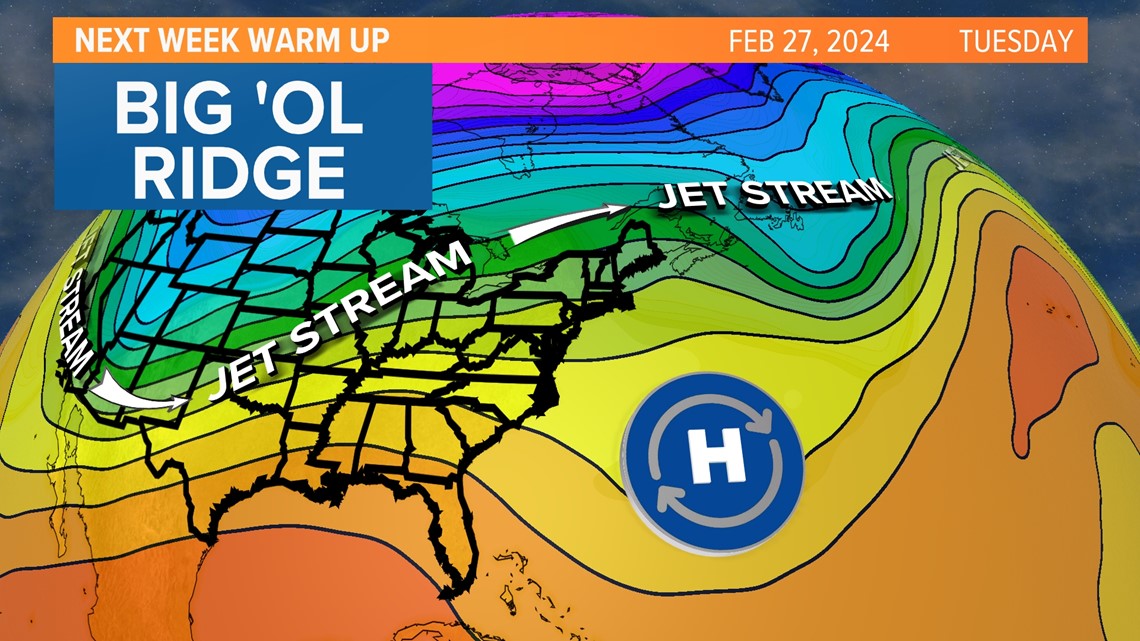
A big ol’ ridge of high pressure moves in from the south in the middle of next week and that means no snow for nearly all of Maine for the next storm by midweek.
Temps will easily be in the 50s statewide.

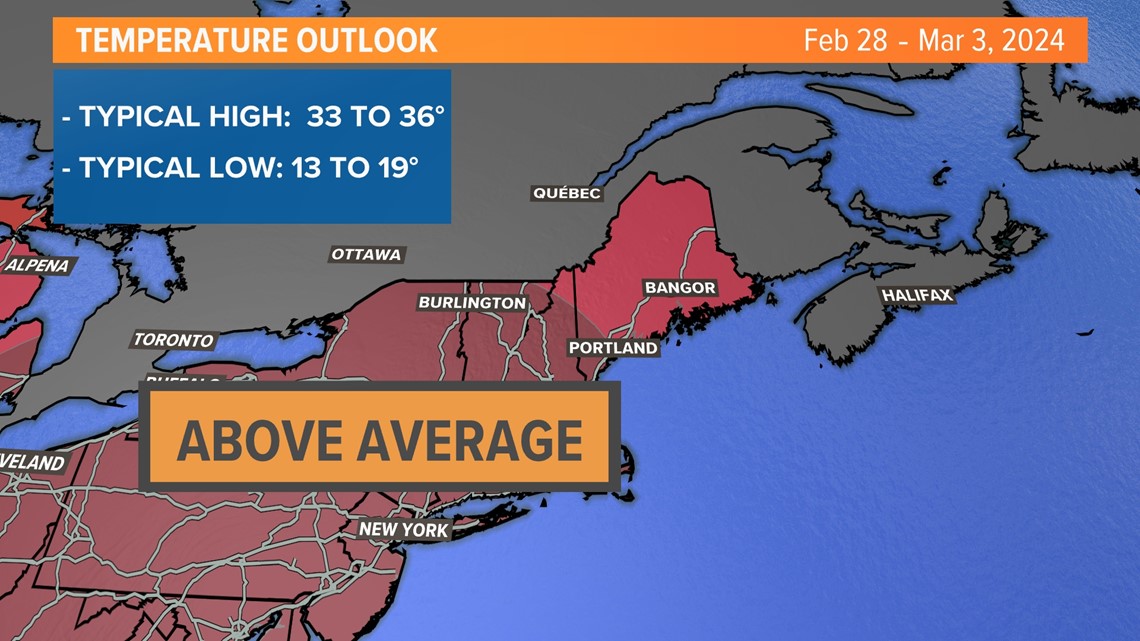
The long range outlook is devastating for snow-lovers, with well-above-average temps taking over Feb. 28- March 3.
I took a look at the ensemble forecasts, and there is a black hole where snow opportunities would normally be this time of year.
I’m not cancelling winter because March, April, May etc. can be quite interesting in Maine, but things don’t look great right now. I can see 60s and a run for 70 in early March, and not much snow.


Follow along for more weather blogs and pizza discussion.

