PORTLAND, Maine — We've been spoiled with lots of brilliant sunshine, refreshing dew points, and high temps in the low 70s, thanks to a cool and dry Canadian airmass.
But to celebrate the unofficial end of summer, summer has decided to make one last stand. I'll give you a hint: It's *not* heat wave material—it's humidity.
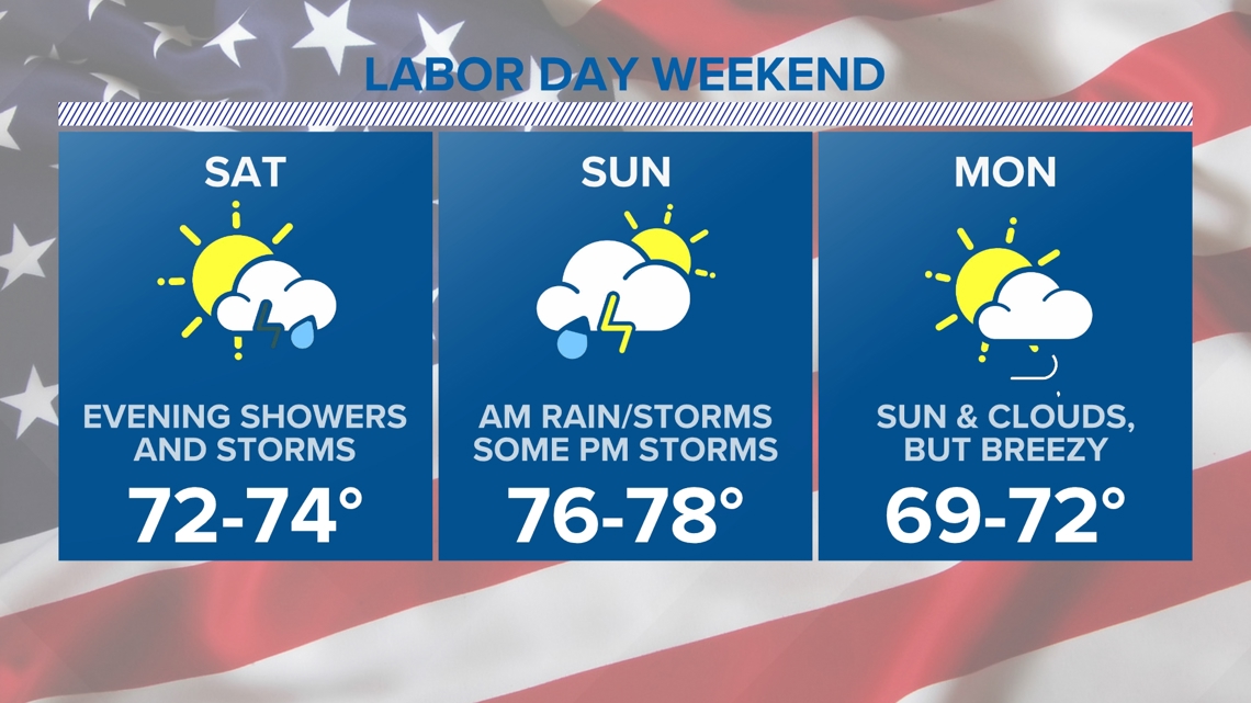
The high pressure over us Friday will begin to depart Saturday. Saturday morning will start out with some fog and more clouds than we've seen the past few days. The first half of the day will be dry as a cold front approaches from our northwest. Temps will remain in the low- to mid-70s, but the humidity will start to creep up again.

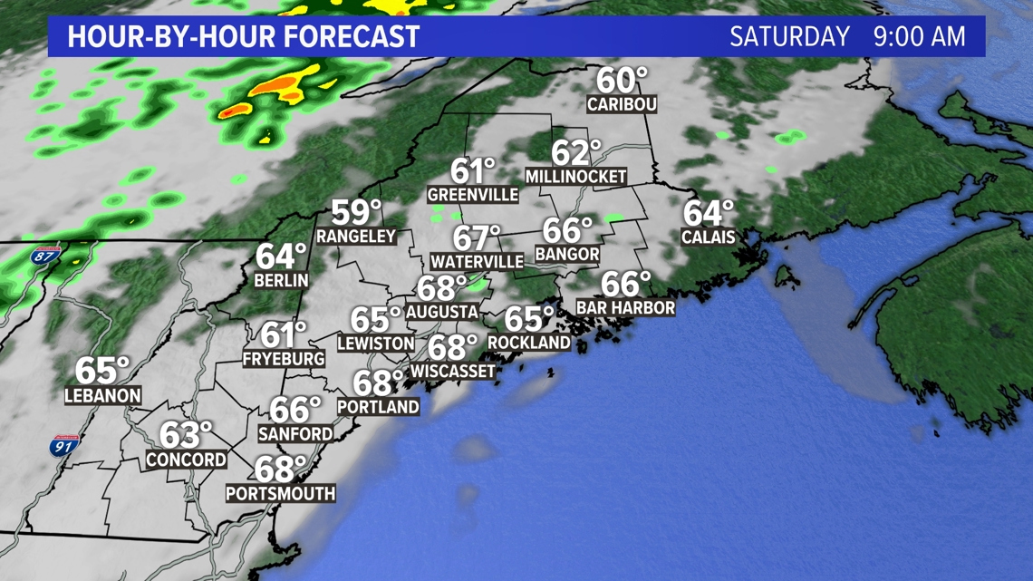
Shower activity, with some embedded thunderstorms, moves into the northern mountains just after lunchtime.

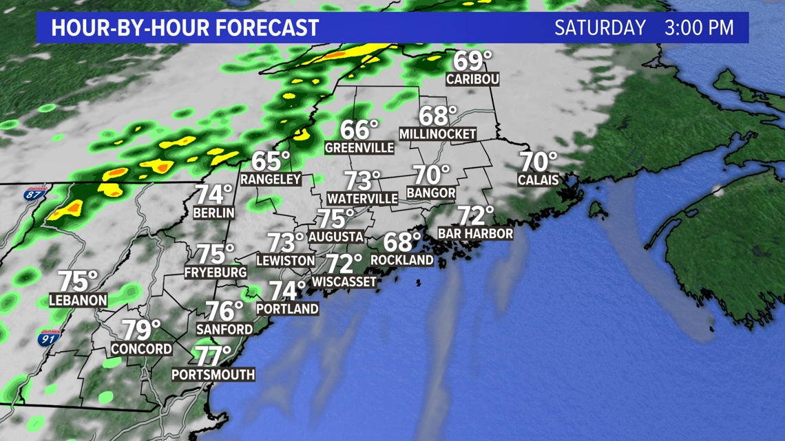
Rain continues through the evening and overnight. Some pockets of heavy rain may cause isolated flooding in flood-prone areas.

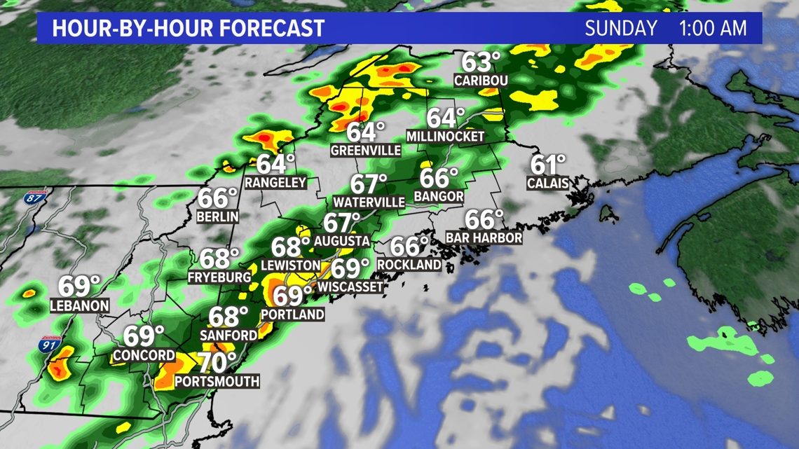
Most of us clear out before noon Sunday morning.

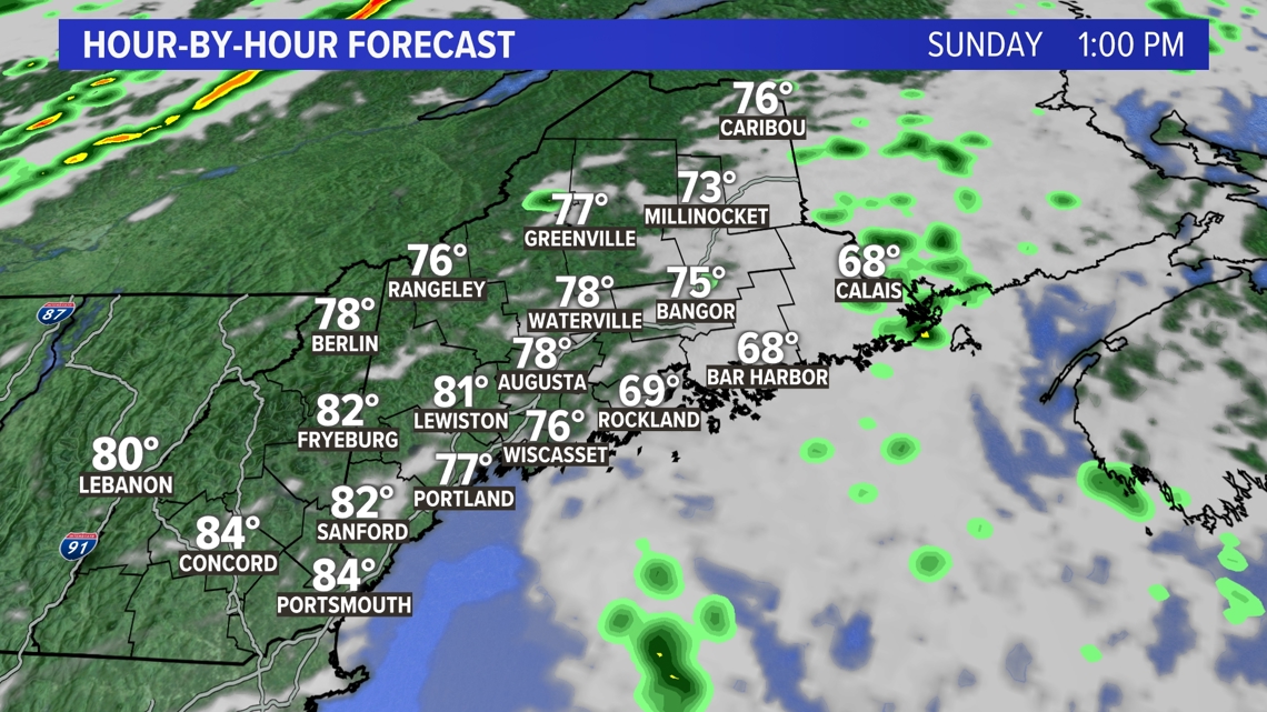
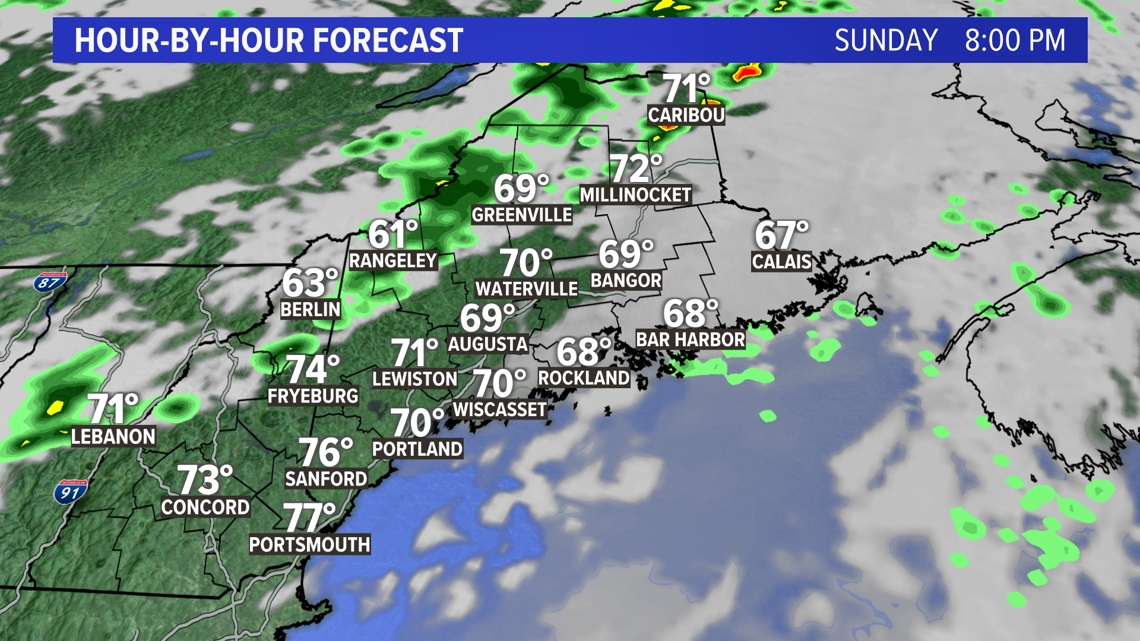
Some isolated thunderstorms may pop up in the afternoon Sunday, but most of us will remain dry. It'll be the warmest and most humid day of the weekend, with temps returning to the upper 70s, and dew points will be quite humid in the afternoon. (Summer's last stand?)
A secondary trough brings a second, but smaller, round of showers Sunday night.

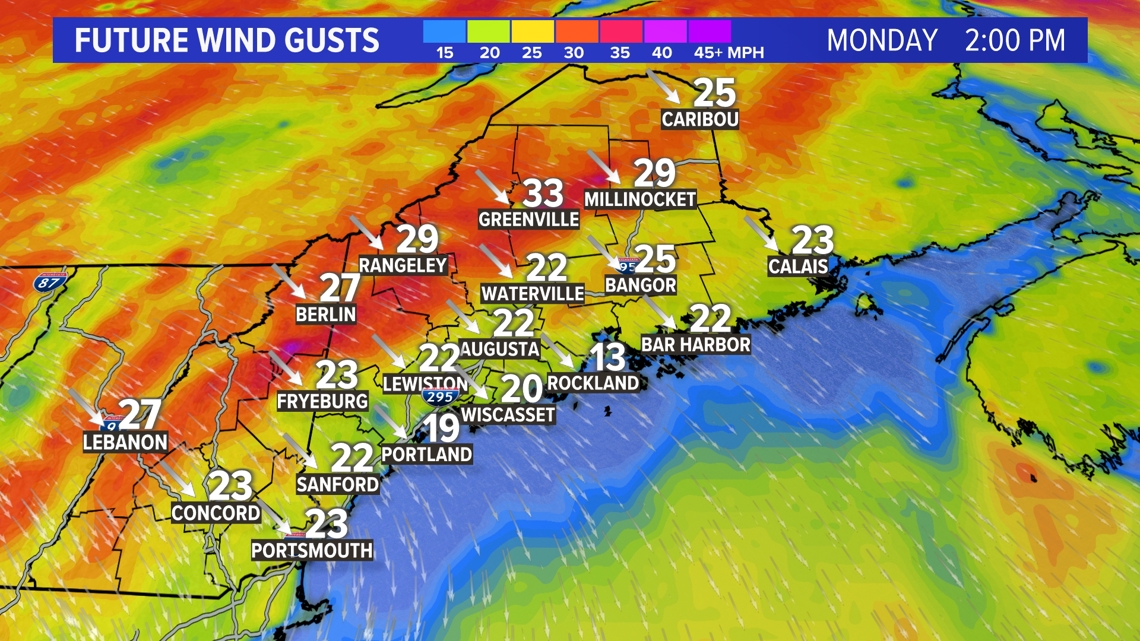
Monday will be dry with a mix of sun and clouds. However, it will be cooler and a bit breezy in the afternoon.

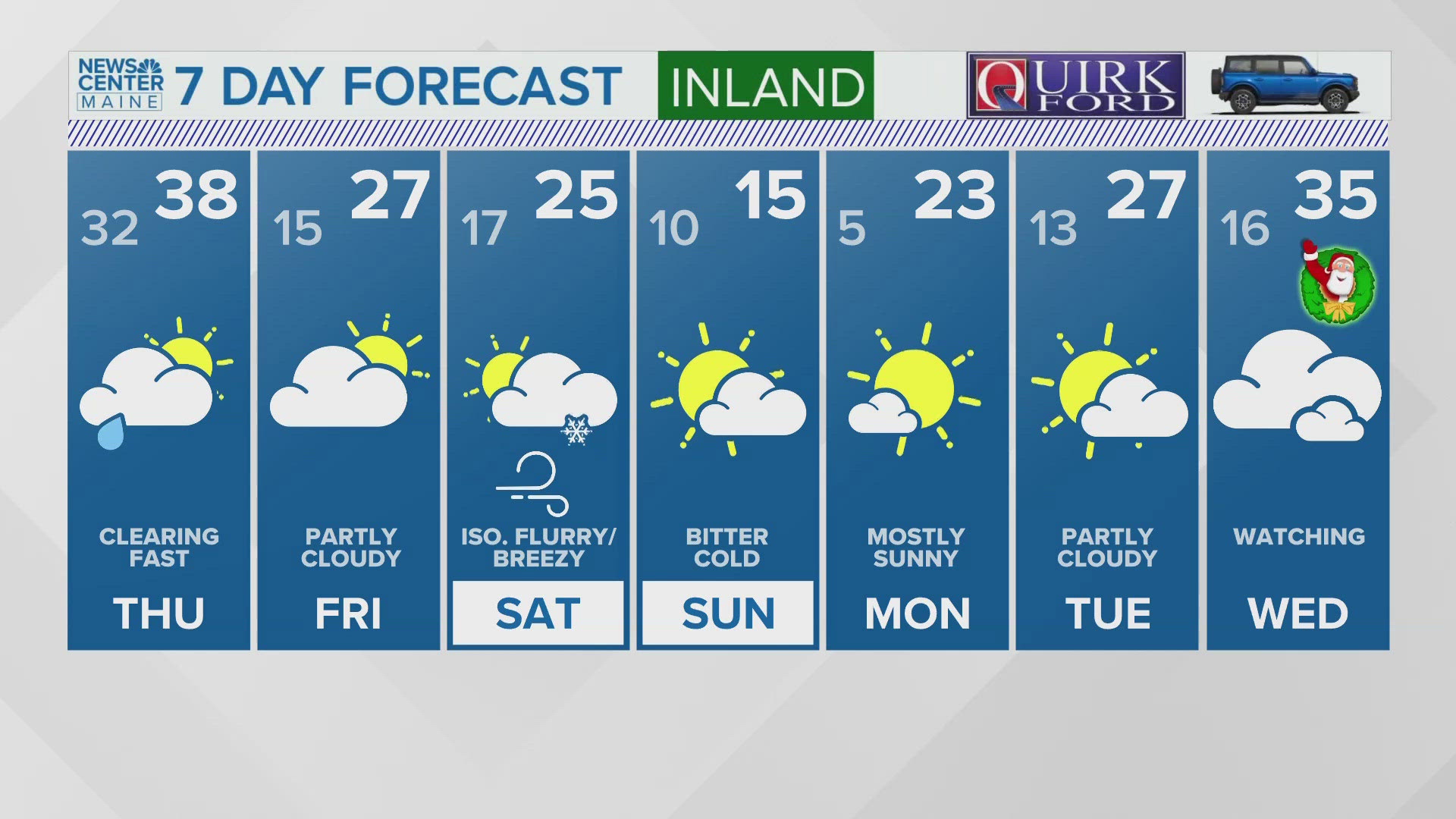
Here's everything I just explained summed up in a handy-dandy graphic!

Enjoy the long weekend!
- Dana