
PORTLAND, Maine — It’s that time of the year when Mr. Grinch rolls into town during the holidays to crush any hopes of a white Christmas.
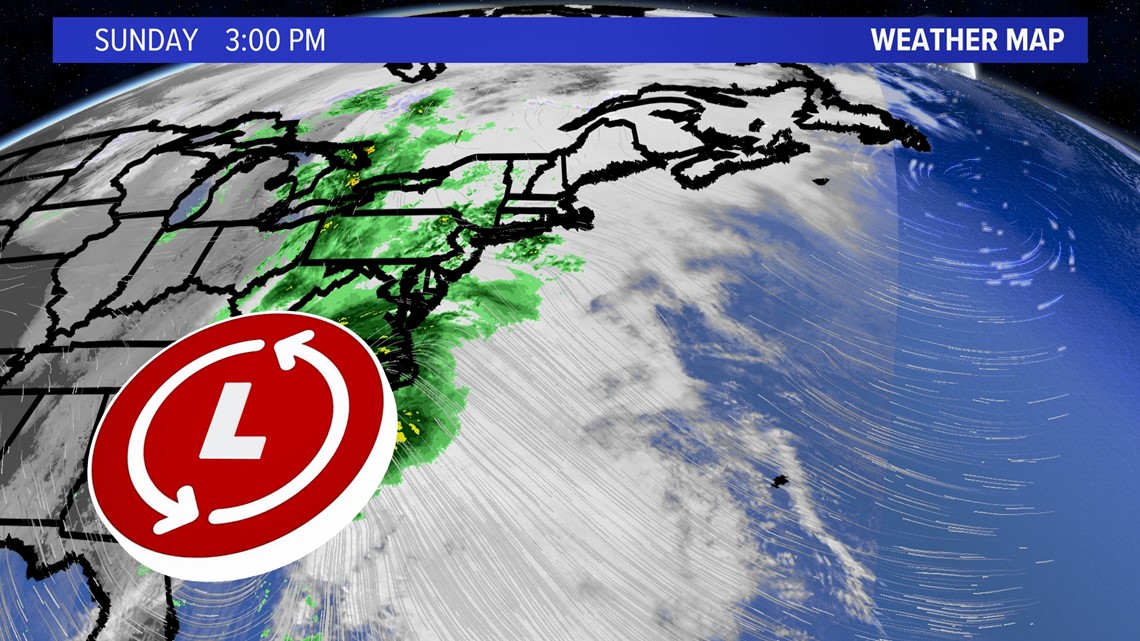
This year’s storm will bring rain starting Sunday evening in southern Maine and push north and east overnight. The worst of the wind holds off until middle of the day Monday with widespread power outages expected for Bangor and Down East.
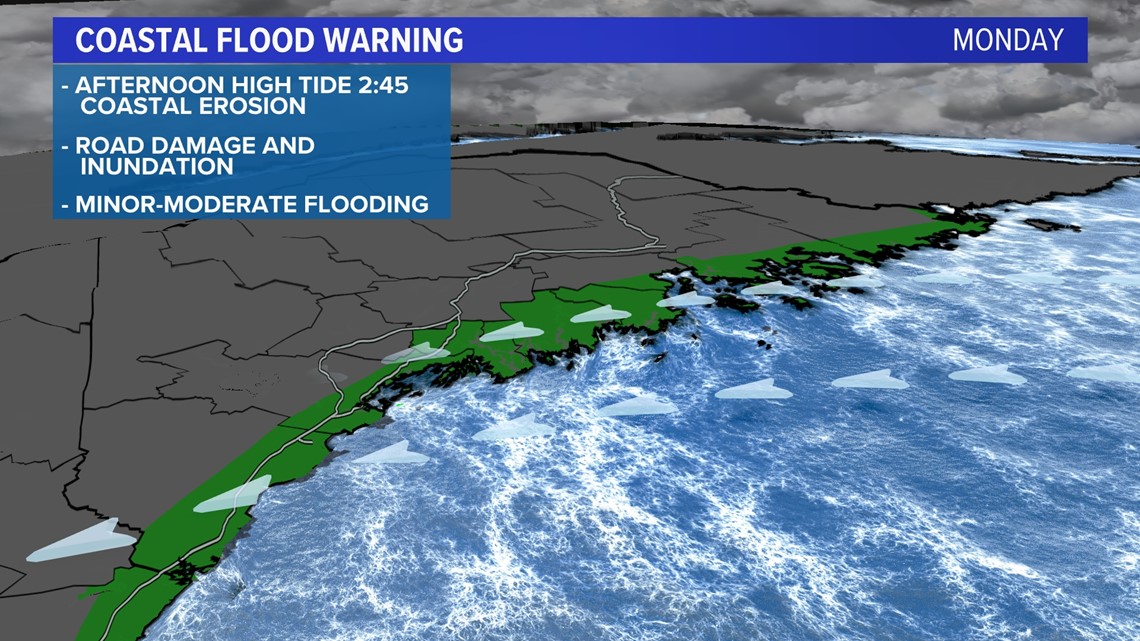
Much like last year’s storm, we will have high seas for the mariners with up to 30-footers near shore along the Down East coastline. Add a few inches of rain with snowmelt and we have a recipe for a major storm in the Pine Tree State. Let’s discuss the details..

Right now, low pressure is strengthening off the coast of Georgia-Carolina and it will only get stronger when a piece of energy from the Ohio Valley merges with the primary coastal low Monday.

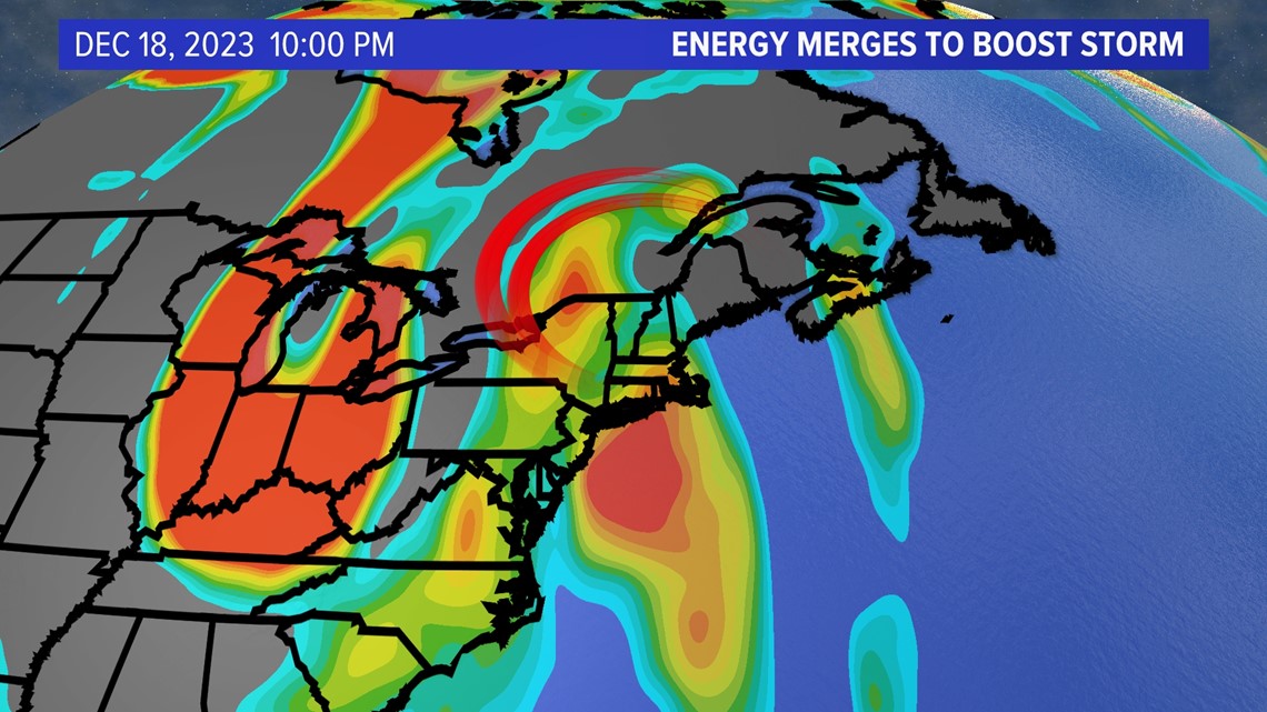
We call this "phasing"—getting a steroid shot of energy to rapidly lower the pressure— deepening the storm.

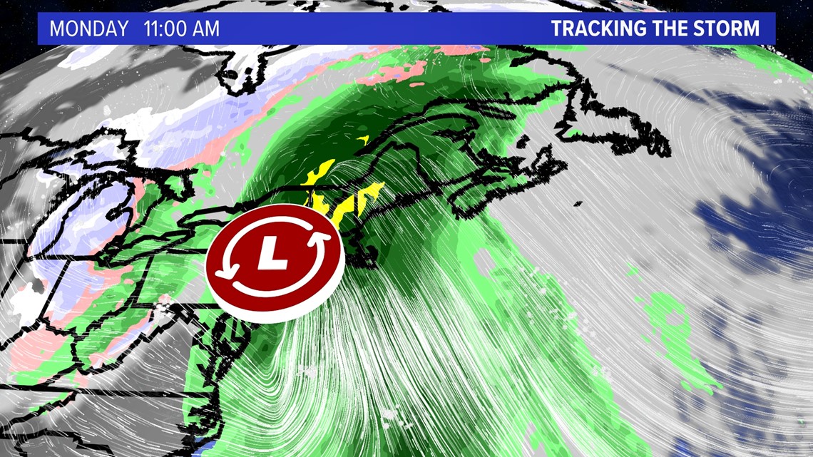
By Monday, the onshore slow of wind will be felt across Maine with steady rain from Presque Isle down to Kittery.

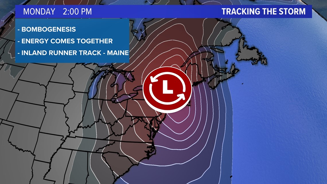
It won’t be a nor’easter or even a coastal storm once it gets here, but it will be powerful.
This is a typical inland runner track, much like last year’s storm around this time. These storm tracks allow plenty of moisture to come off the ocean, pull up into ridgelines, and get squeezed out with the upslope flow.

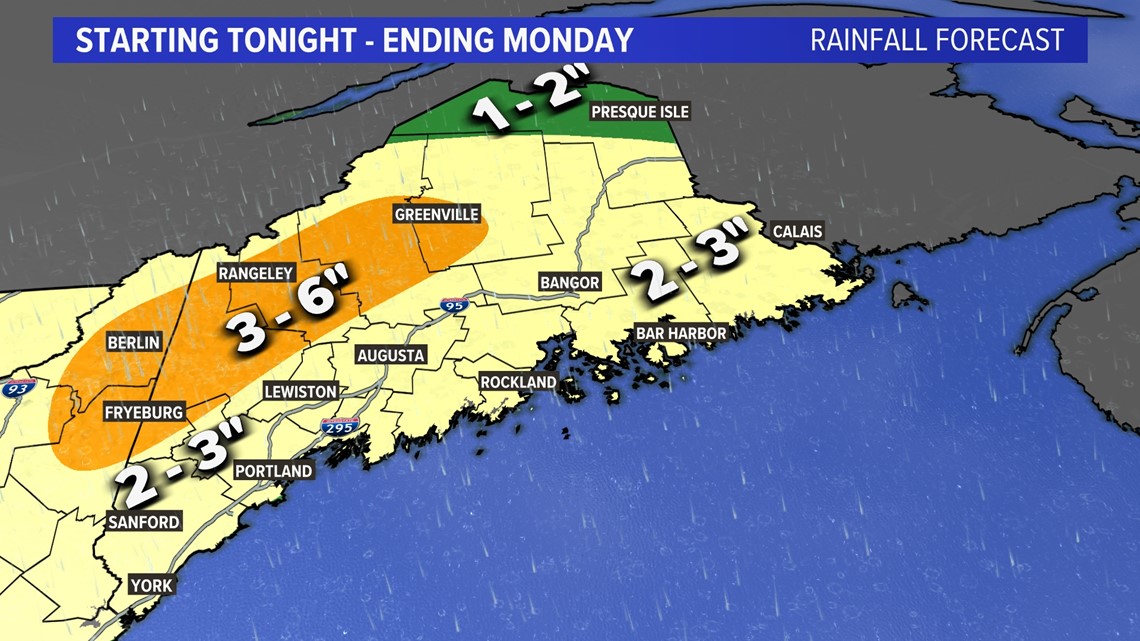
It’s a recipe for a lot of rain in the order of at least 3 to 4 inches for the southeast facing slopes of the western Maine mountains and the White Mountains of New Hampshire. I can see more than 5 inches locally for total accumulation. That’s a big problem with added snowmelt.

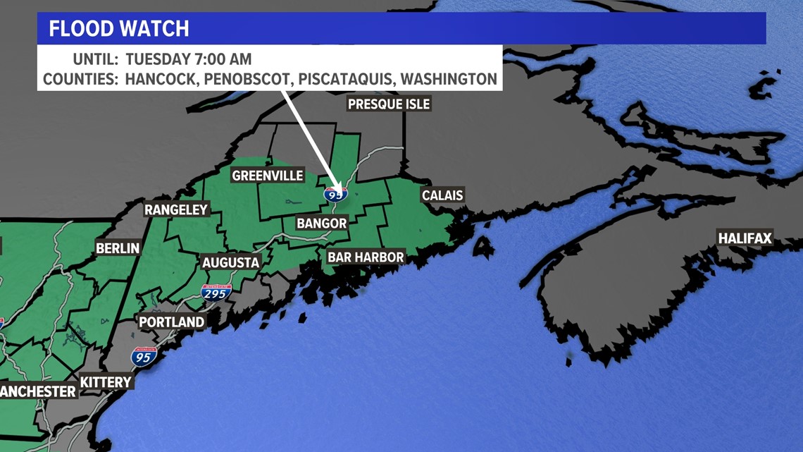
The green counties have flood watches up through Tuesday due to rapid snowmelt and runoff. I’d watch the Kennebec and Penobscot Rivers closely.

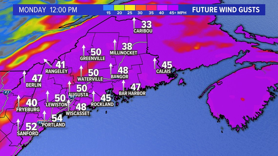
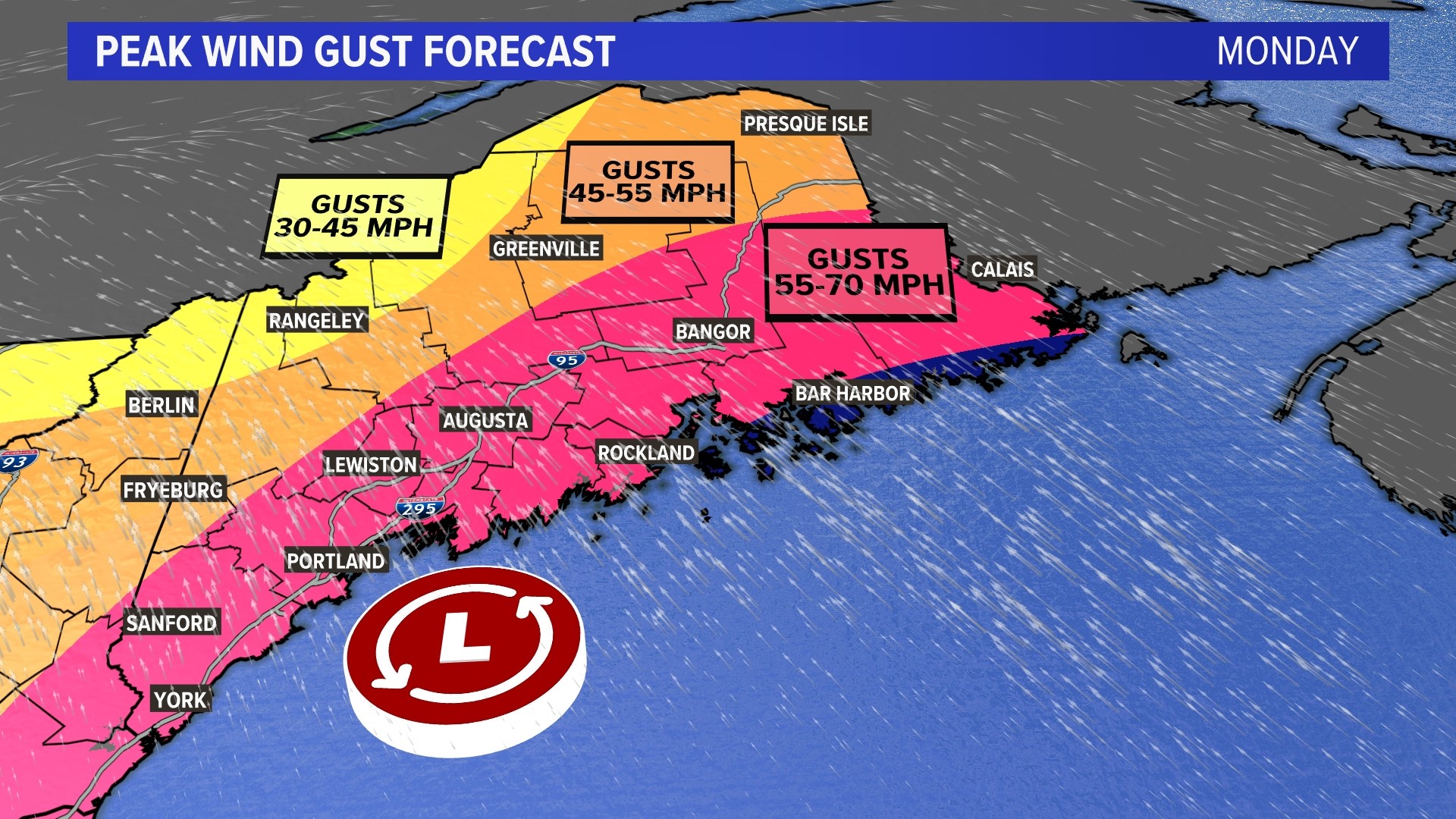
Wind is also a major factor with this storm as a low-level jet stream will be moving through the region Monday. Think of this like a low-flying plane, and with enough heavy rain the high wind a few thousand feet in the sky, will be transported down to ground level. The Down East and Bangor regions will see the worst of it Monday with gusts of more than 60 mph.

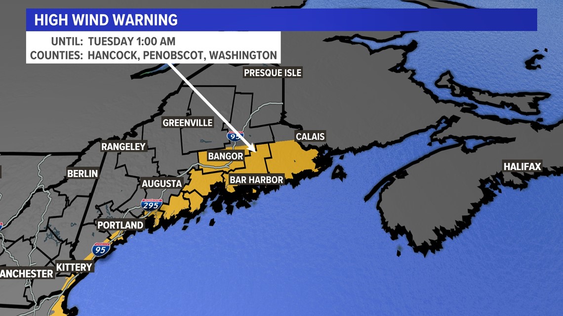
Wind warnings are up so it’s a good time to bring in the holiday decorations.

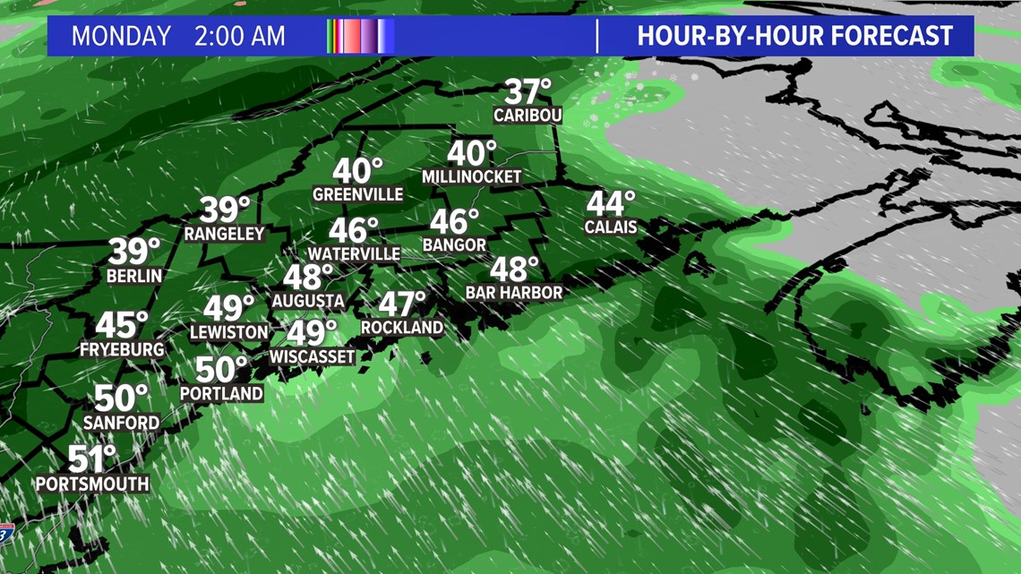
By 2 a.m. Monday the storm is covering the entire state with rain.

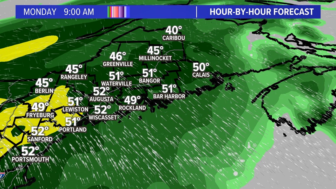
Still raining, and it’s coming down heavily in southern Maine.

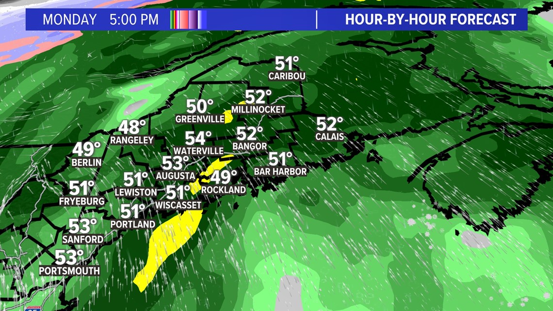
Storm is winding down for southern Maine but cranking elsewhere.

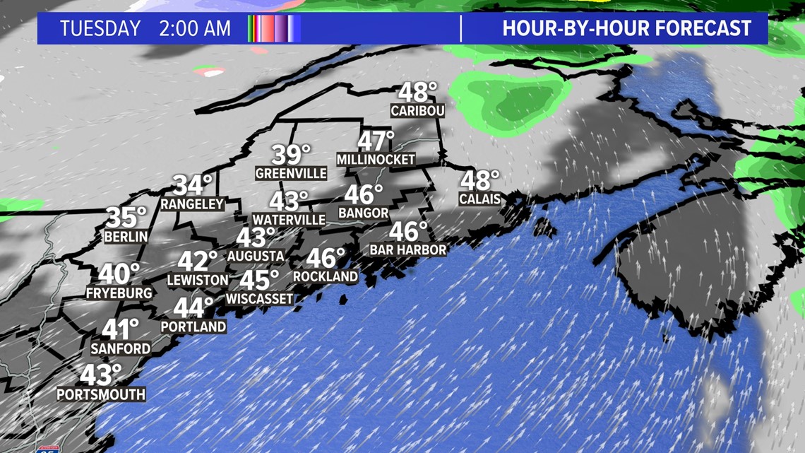
It’s over.

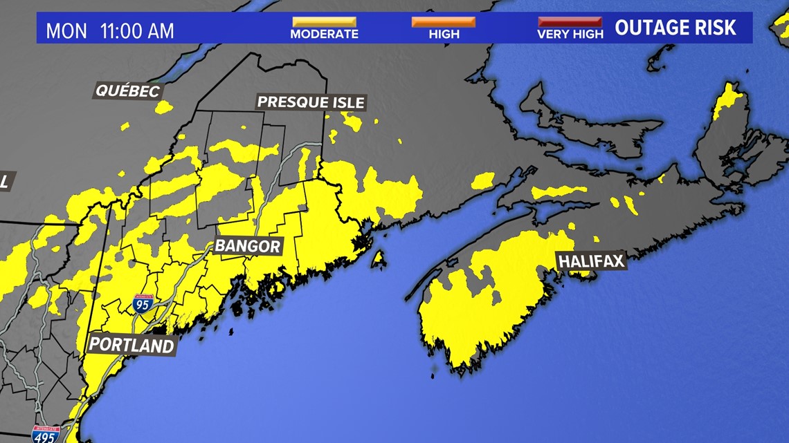
The power outage threat is greatest Down East, but even the hilltops will see gusts of more than 50 mph.

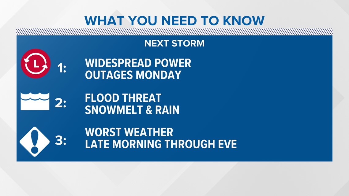
Coastal flooding will also be an issue on Monday during afternoon high tide.

Here’s a summary of what I expect for the storm. I do not expect any snow to be left in Maine for Christmas. You can thank Mr. Grinch.


Follow along for more weather blogs and pizza discussion.