PORTLAND, Maine — Maine is seeing high to peak fall foliage right now, but that could all change with a storm set to move into the region soon.

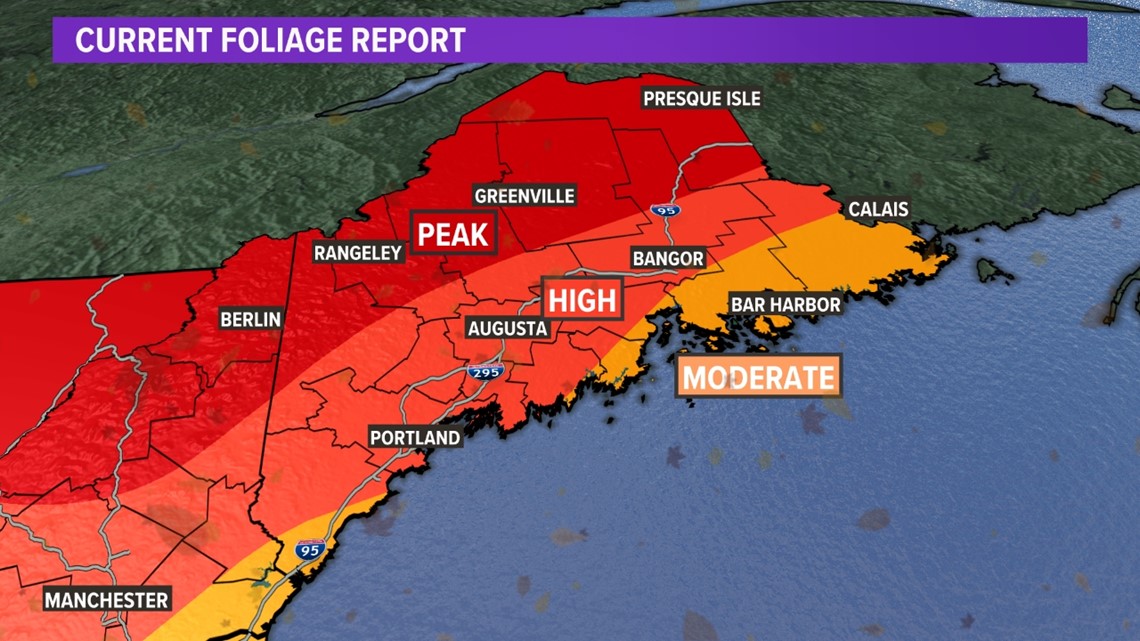
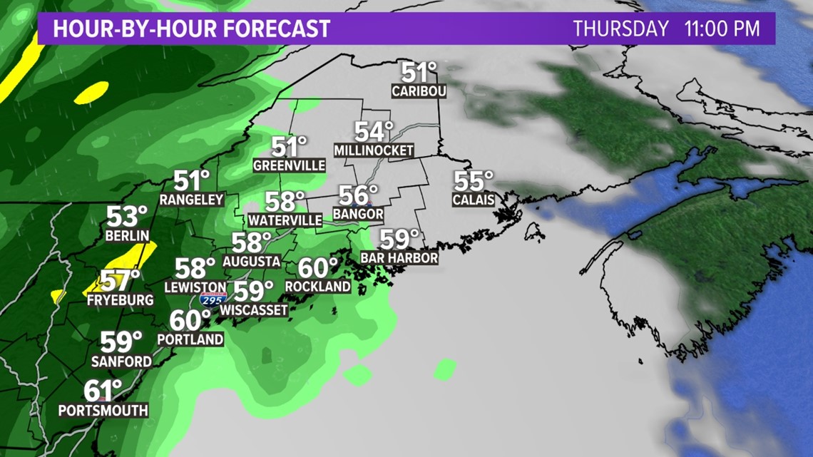
The heavy rain begins Thursday night, moving into the state from west to east. Here is an hour-by-hour timeline of what to expect:
Thursday at 11 p.m. will see the first batch of heavy rain over New Hampshire and western Maine.

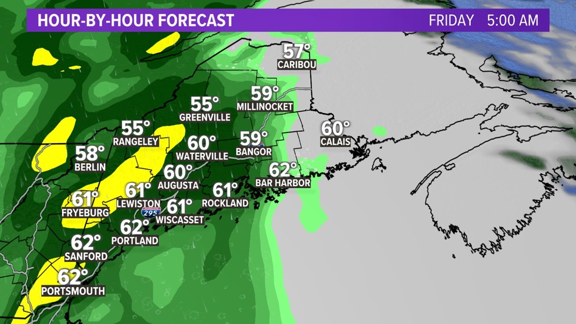
The heavy rain spreads east into central Maine and the midcoast by 5 a.m. Friday.

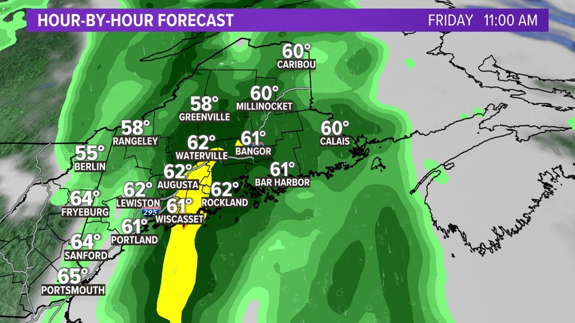
By 11 a.m. Friday the heaviest rain is over the midcoast, central Maine and Down East. The southern coast and western Maine are seeing lighter showers and partial clearing in New Hampshire.

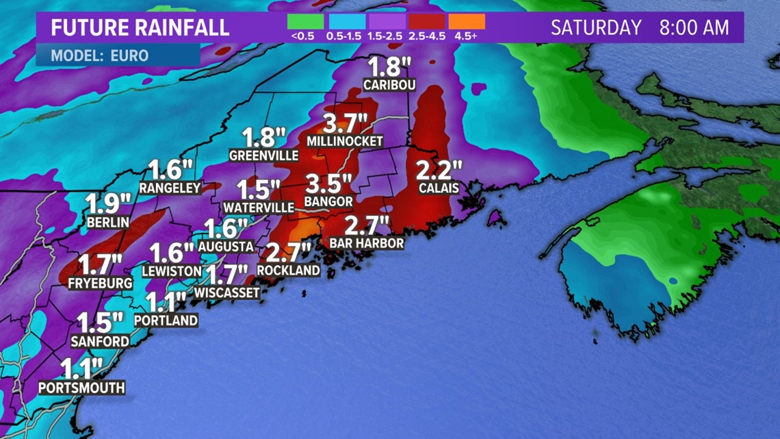
Future rainfall amounts range from 1 inch to more than 3 inches, especially if the storm stalls Saturday morning. This will cause problems for some basements with flooding a threat. Leaves will also come down and clog gutters and drains.

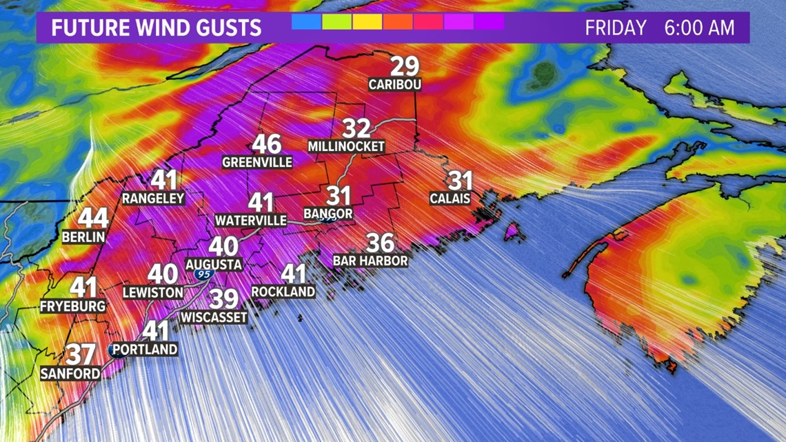
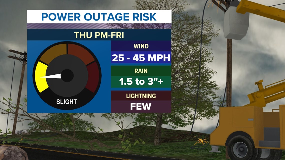
Peak wind gusts will cause scattered power outages across the state. This is due to the leaves still being on most trees.

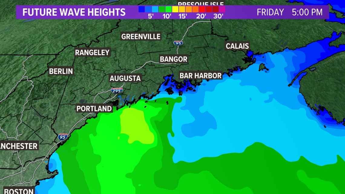
There will also be big waves due to a strong southeasterly flow coming off the Gulf of Maine. Waves of more than 5 feet will build Thursday into Friday. A Gale Watch could be issued by the National Weather Service for late in the week.

Here is a recap of the power outage threat:

For the latest forecast and to track the storm with me go to my Facebook and Twitter pages. NEWS CENTER Maine will share updates as we get closer to the storm's arrival.
- NEWS CENTER Maine Meteorologist Jason Nappi

