
NEW ORLEANS —
Tracking the Tropics:
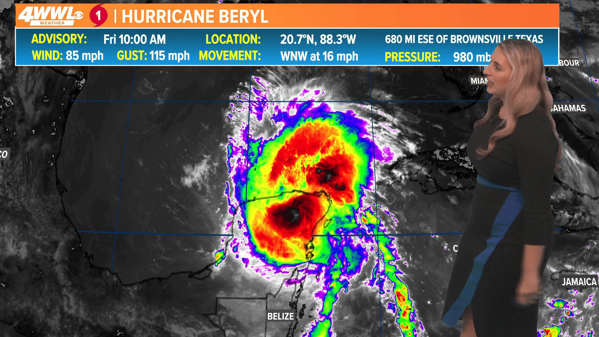
Hurricane Beryl made landfall in the Yucatan Peninsula of Mexico Friday bringing heavy rain, strong winds, and storm surge. Shortly before 1 p.m., Beryl weakened to a tropical storm as it interacted with the terrain of the Yucatan and will then move into the southern Gulf of Mexico this weekend. Some re-strengthening is possible over the warm Gulf waters and Beryl may become a Category 1 or possibly a weak Category 2 hurricane when it makes landfall in either northern Mexico or south Texas late this weekend into Monday. South Texas and northern Mexico will see heavy rain, gusty winds, beach hazards, and potential coastal flooding.
While western Louisiana is in the latest NHC cone, this indicates that the remnants of Beryl once it moves inland will spread farther north and east bringing some increased rainfall and breezy conditions across east Texas and western Louisiana early this week.
There are no direct impacts expected in southeast Louisiana or south MS from Beryl. Southerly onshore winds will increase early this week which could translate to elevated high tides and rough boating conditions early this week along the immediate coastline in southeast Louisiana and south MS. It may get breezy across the local area early this week too, especially at the coast.
The rest of the tropics are set to remain quiet over the next week.