
FLORIDA, USA — Hurricane Milton underwent rapid intensification Sunday night and by Monday afternoon has reached category 5 status as it churns just off the Yucatan Peninsula.

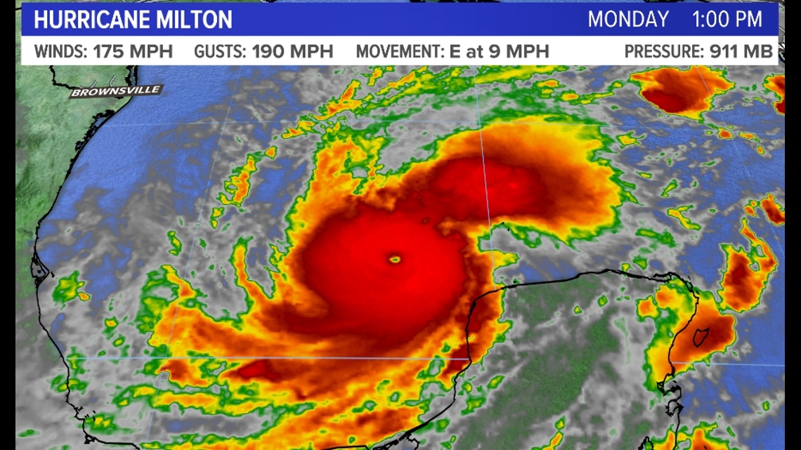
As of 3 p.m. Monday — hurricane intensity can change quickly so detailed timestamps are needed here — sustained winds were sitting at 175 mph with gusts up to 190 mph. These are huge numbers.
Perhaps more concerning to me from a meteorological standpoint is the presentation of Milton on satellite. It is VERY well formed.

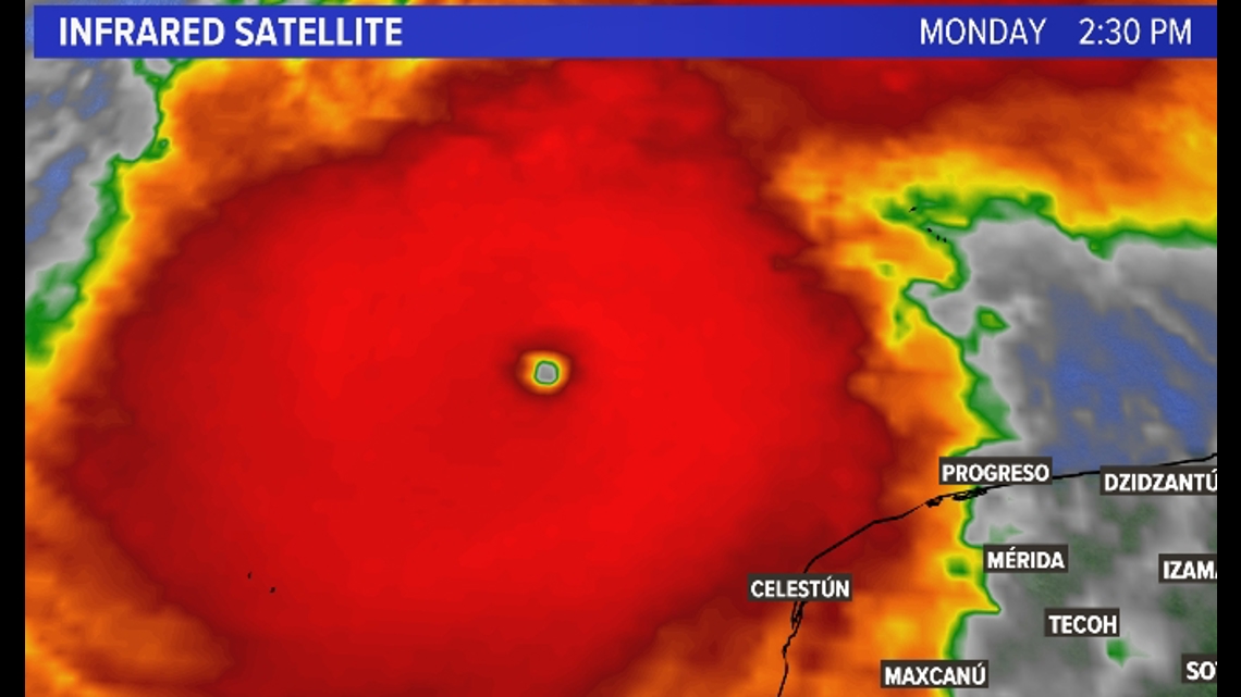
Look at the nearly perfectly symmetrical eye, eyewall, and outer bands. In general, the more symmetrical a tropical system is, the better organized and stronger it is.
Right now, Milton is in near ideal tropical conditions, so it is expected to remain a category 5 or category 4 hurricane throughout the evening Monday and into Tuesday.
Now for the important part: Where is this storm headed?

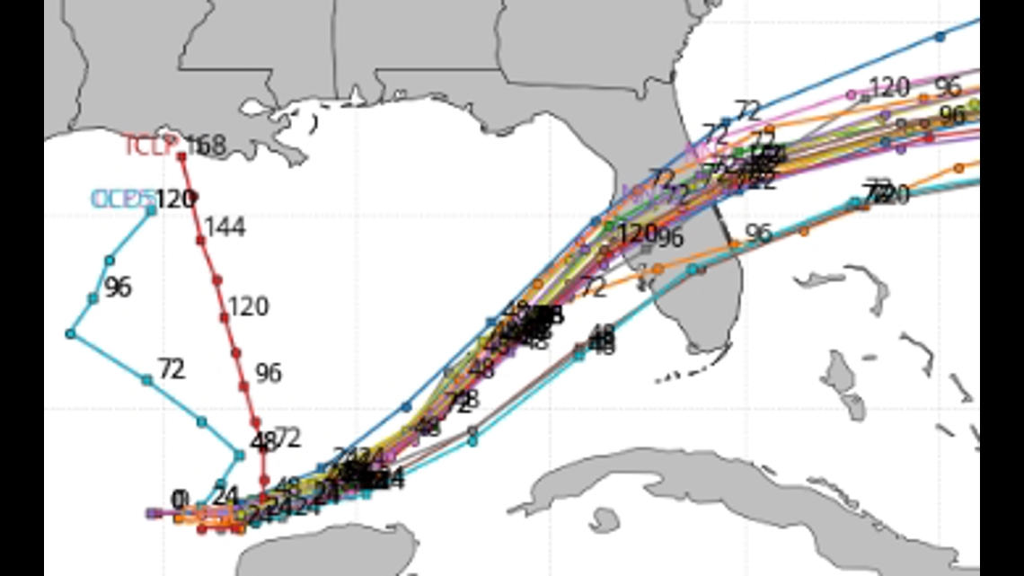
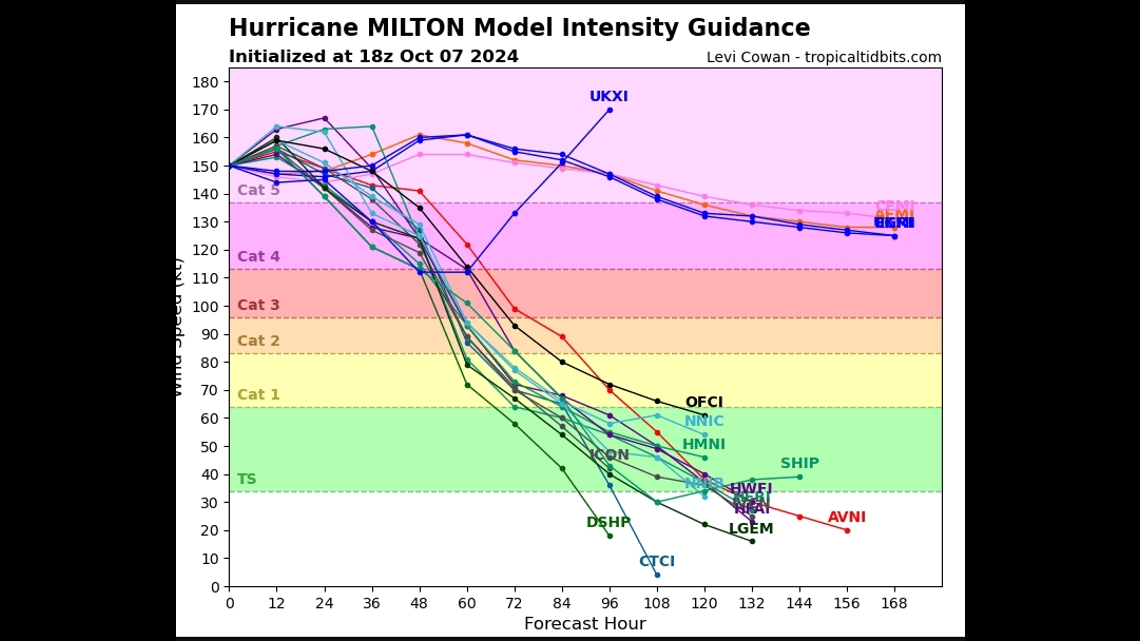
Each line on the above map is a computer model projection of the future path of Milton. Given we are a few days out from expected landfall, this is a pretty good agreement that the Tampa area is the most likely to be directly hit by the storm.
Ignore the straight northern two lines — those are called persistence plots — they basically assume a hurricane will keep moving the way it has over the past 12 hours. That's not how the atmosphere works. If it did, we'd never miss a forecast.

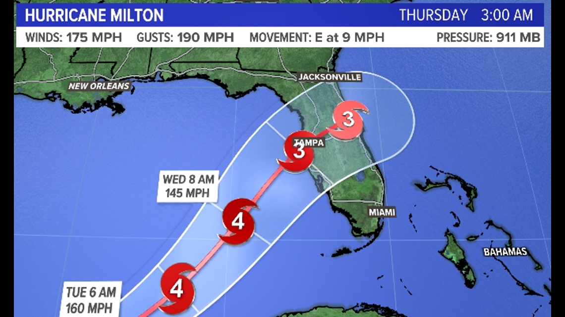
The National Hurricane Center forecast is generally in agreement with the computer models with landfall occurring later on Wednesday near Tampa, FL. The "cone," however, is there for a reason, reminding people of uncertainty in the north and south direction at this time.
You'll probably notice that the NHC has Milton making landfall as a category 3 hurricane instead of the category 5 it is right now. That's due to some pretty stiff wind shear in its path — wind shear tends to break up the structure of a hurricane and disturbs how it "breathes."
This, again, is in line with most computer model guidance. But it's worth noting that in some models Milton is still a category 4 upon landfall, and I think that's a very real possibility.

So, if we are looking at a "low-end" category 4 or high-end category 3 upon landfall, the storm surge will be very significant.


Right now, the storm surge is projected to be up to 12 feet. To put that into perspective when Portland broke its all-time water level record last winter, we did it with a storm surge under 4 feet. To be fair it was a high astronomical tide as well, but the comparison is still important.
Major damage seems all but guaranteed on the west coast of Florida just a few weeks after Hurricane Helene hit some of the same areas.
Keith
RELATED: NEWS CENTER Maine Weather Forecast