
Peak hurricane season is right around the corner and it’s starting to feel like it in the Atlantic and Pacific basins. Let’s break down what’s going on with the latest on Hurricane Hilary Saturday.

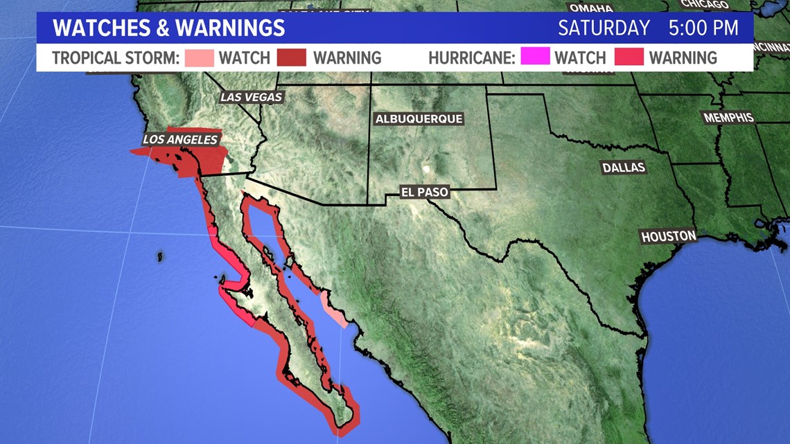
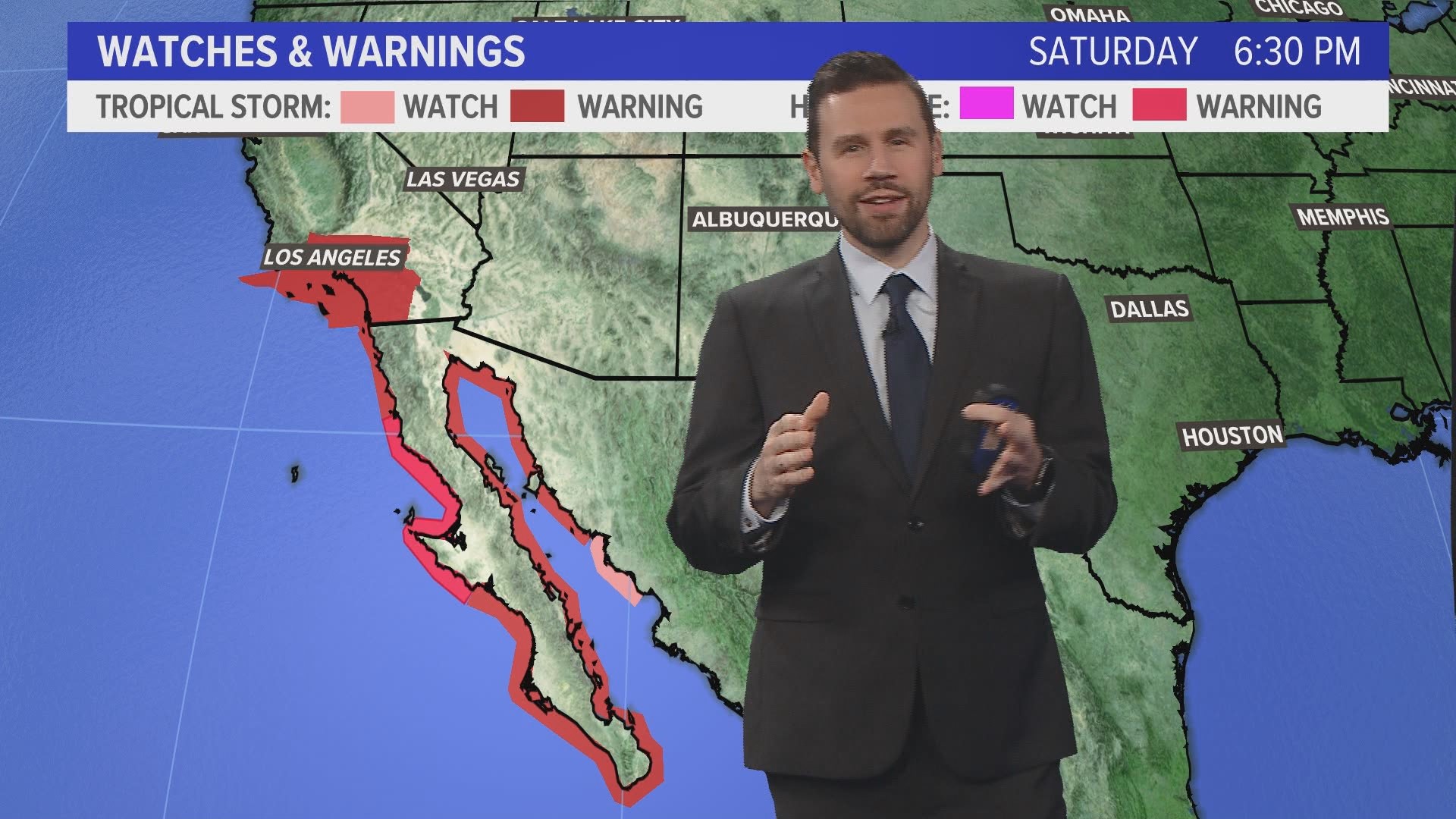
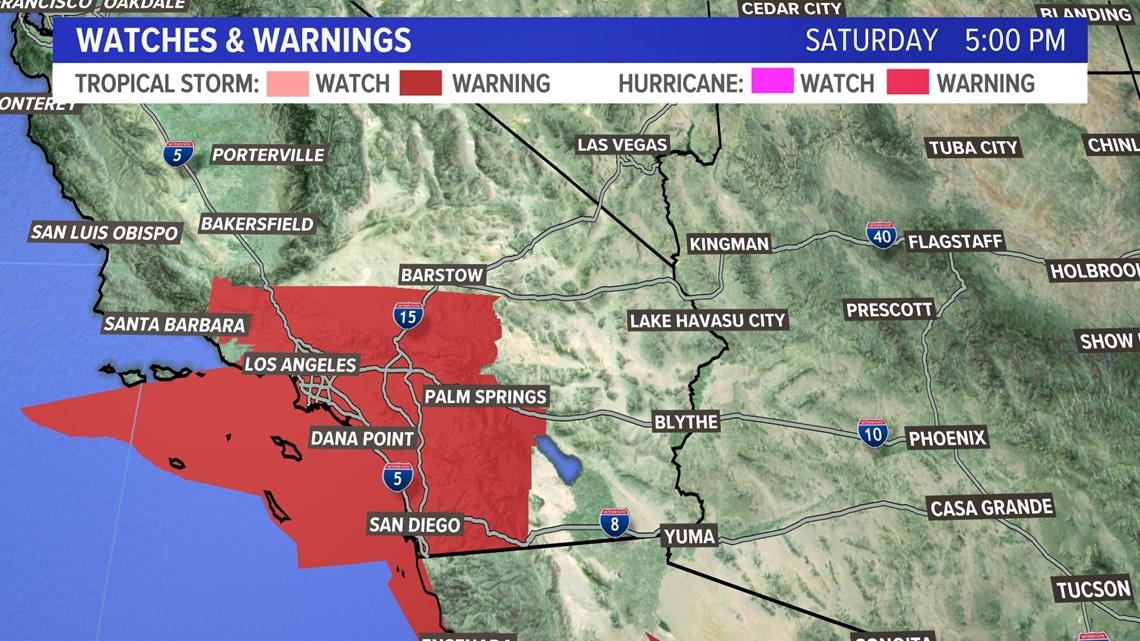
Hurricane warnings are up for the Baja of California with tropical storm warnings up for the Los Angeles metropolitan area.

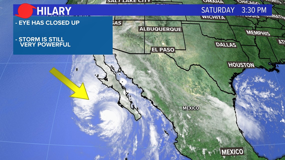
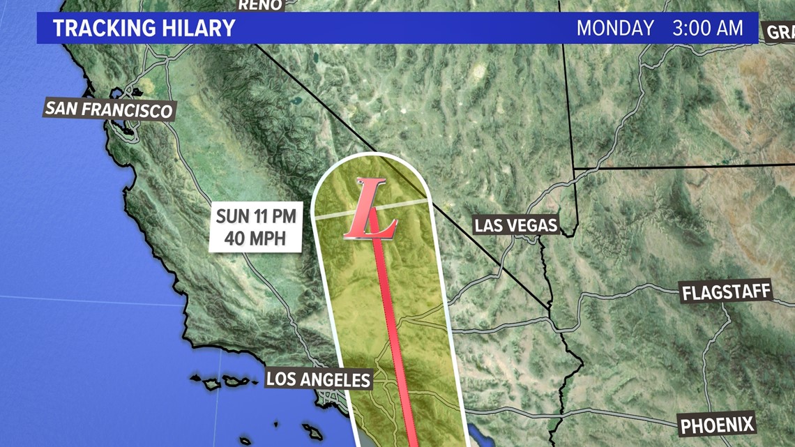
Conditions will being to deteriorate tonight through early Monday morning. As the storm lowers in category number the wind field will expand. Look at the eye closing up on the satellite picture Saturday.

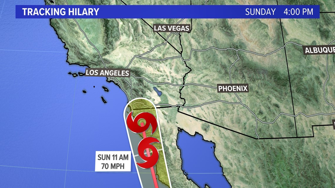
The latest track of Hilary takes the center of circulation east of Los Angeles during the day on Sunday. It will strike San Diego in the morning.


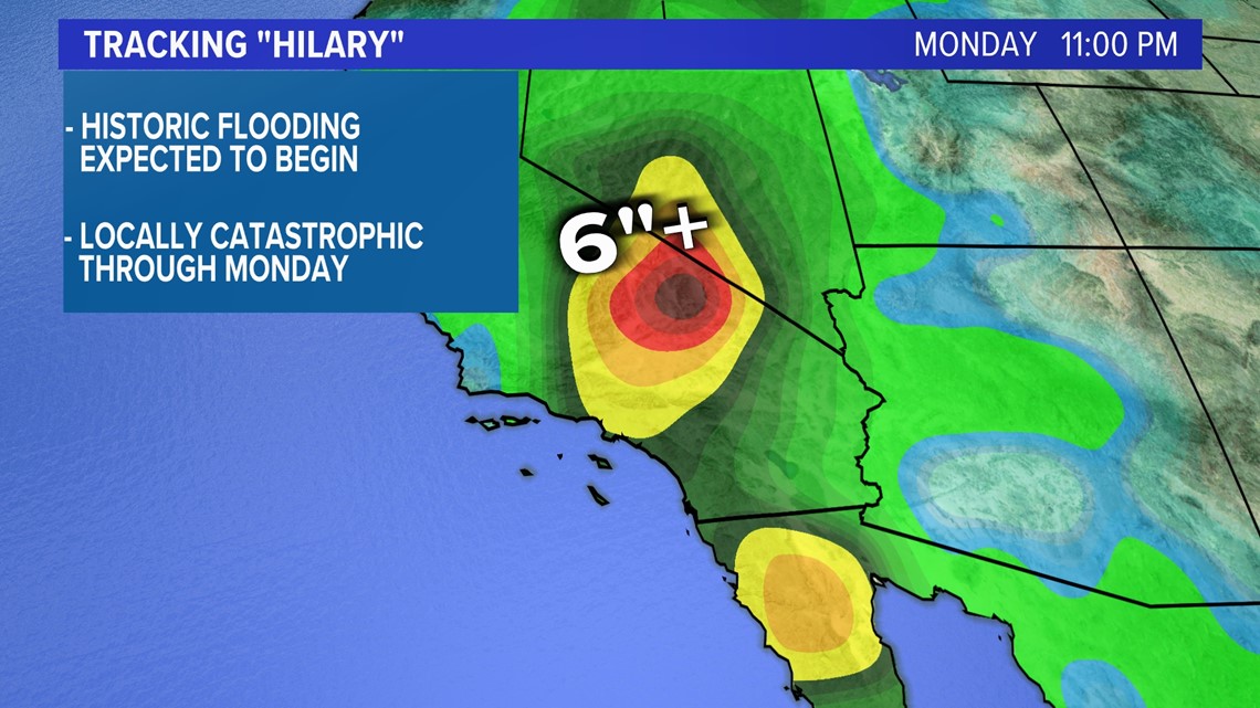
The flooding rains will begin well before the center of circulation hits California. Dangerous to catastrophic flooding is expected on a local level for southern California and extending into southern Nevada. More than 6 to 10 inches or more of rain is expected.

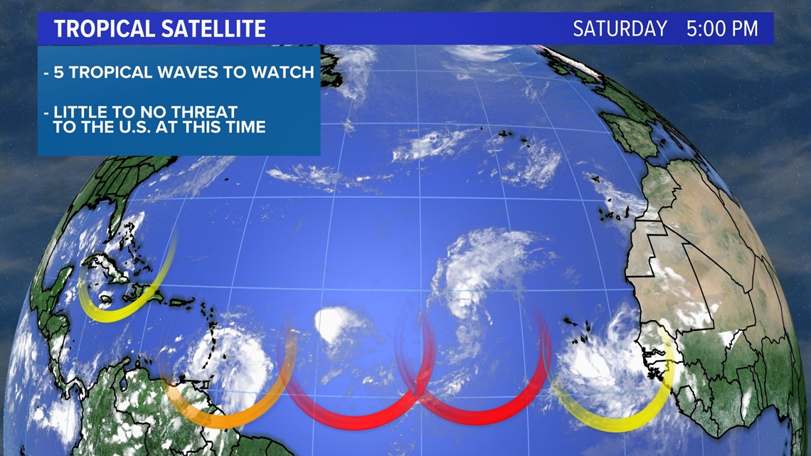
The Atlantic Basin has 5 areas of interest that the National Hurricane Center is tracking. 2 of the areas circled in red have a high chance to develop in the next 2 days or less. However, these tropical waves are no threat to the United States at this time.

It is important to note that we are entering peak hurricane season and all coastal communities should have a hurricane plan in place. It only takes one storm to have devastating impacts.
You can get the latest updates by following me on social media: