
This is not what you want to see entering the last few days of January. The recent January thaw really did a number on the State's snowpack.
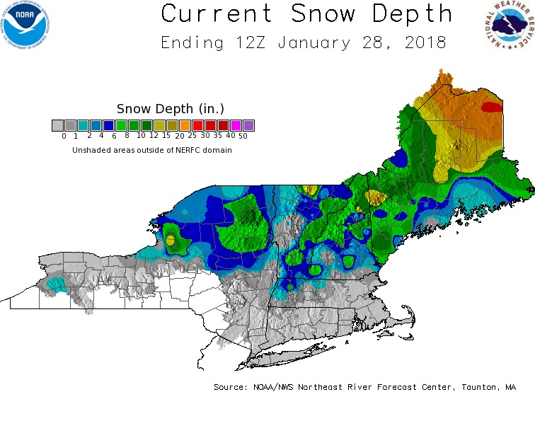
The only part of the state still doing well is northern Maine. Most areas have very limited snow on the ground and some spots even have bare ground.
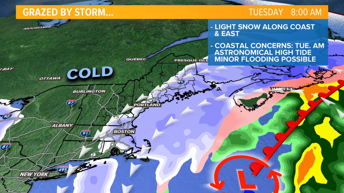
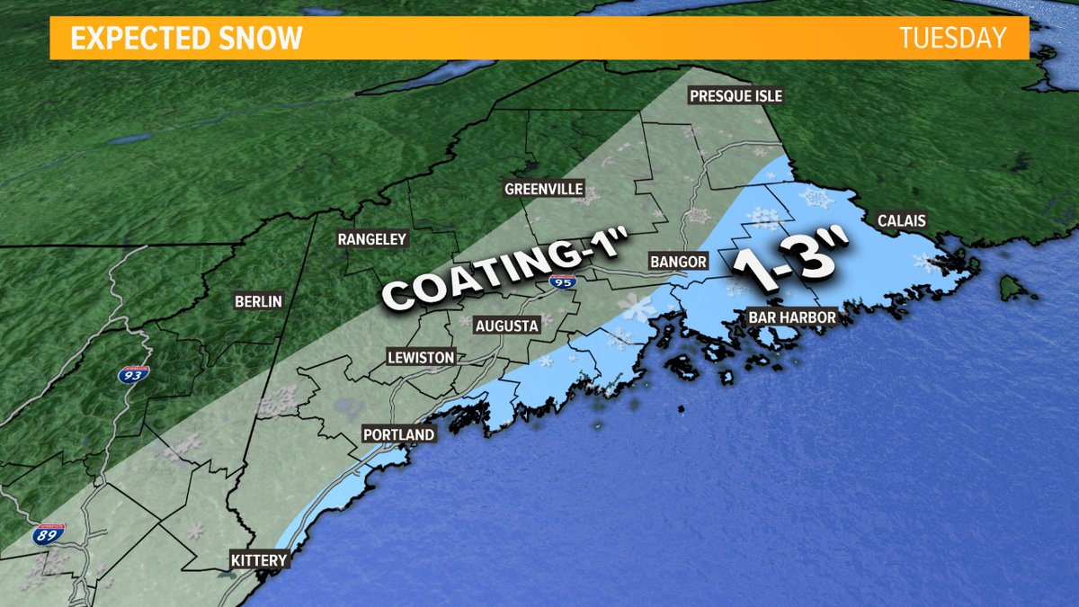
Later Monday and into Tuesday, the western flank of a very large ocean storm will graze the New England coast. The storm will be very far out there so we miss out on the mesoscale banding. But, periods of light snow will be draped over the coastline and roads may be slick in the morning. Accumulations will be minor, generally an inch or less. However, Downeast locals will get a little enhancement.
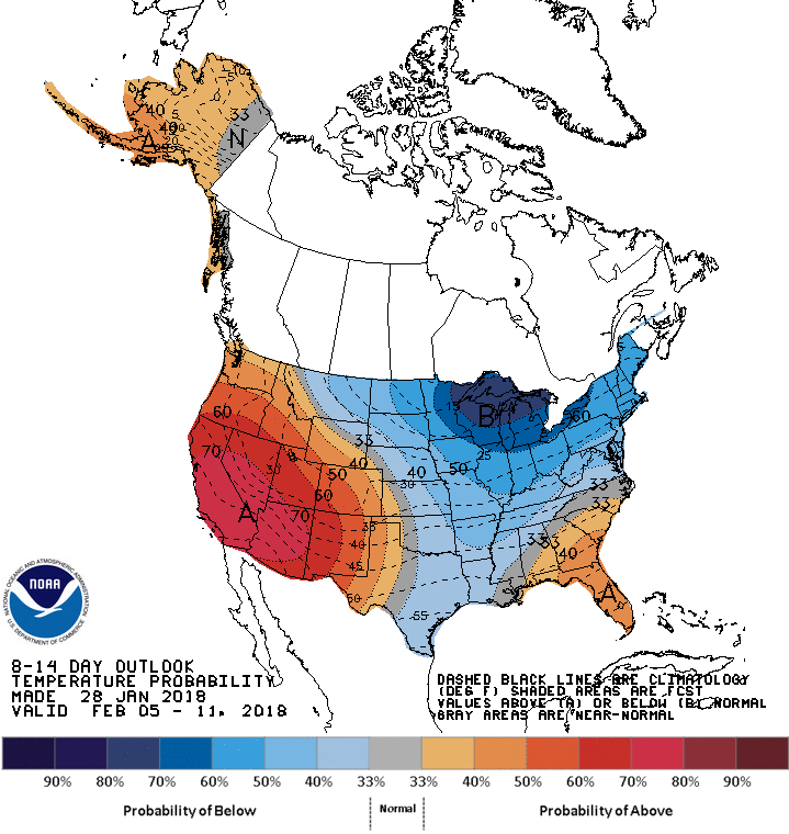
If you crave more snow than just an inch or so, the evolving pattern will excite you. An East Coast trough will become reestablished for the next couple of weeks. This will keep temps at or below normal, and energy rounding the trough will attempt to spawn storms too. More snow is in our future, it's just a question of how much.
Todd Gutner
https://twitter.com/Todd_Gutner
https://www.instagram.com/tgutner/