The first storm of the season was a simple one and didn't cause too many problems.
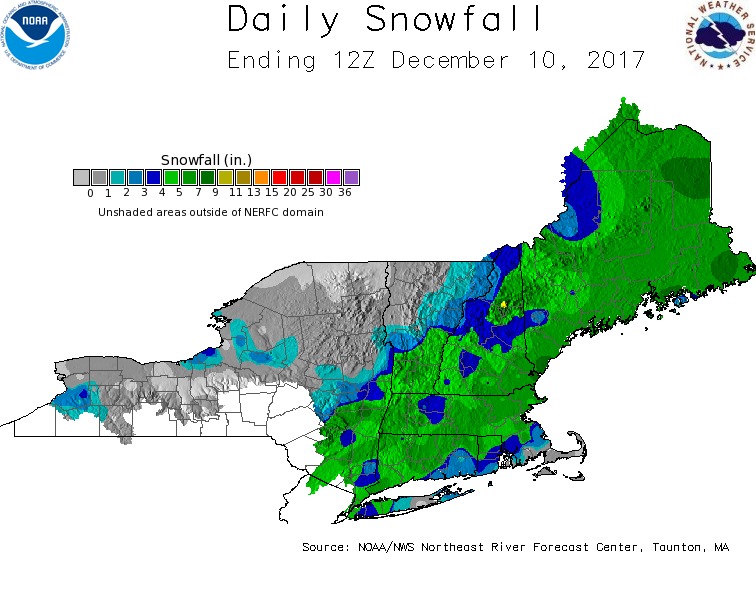
Most areas received 3-6" of snow. The next one won't be so easy. There will be mixing issues and big wind and cold on the backside too.
When we put out our Winter snowfall forecast we cited "Clippers" as the key to big snowfall this season. Well, that's exactly what's heading our way for tomorrow. The initial impulse will induce light snow by daybreak. Snow will immediately begin to stick and roads will get slippery if not treated or plowed during the commute.
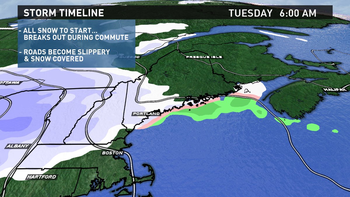
Energy will then transfer to the coast during the day, cyclogenesis will spin up a secondary low which will intensify and lock cold in over the State. Timing and placement of this development is critical and still in flux. But, it appears that enough mild air will be permitted to flow in off the ocean, mixing with or even changing over to rain is expected before the secondary can cut-off the mild flow of maritime air.
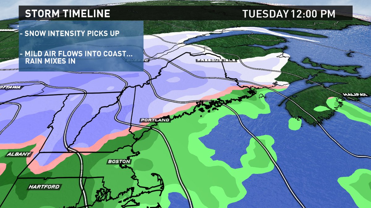
As the new low continues to strengthen and mid level energy arrives, precipitation intensity will really pick up. Inland, in the all snow zone, snow rates will top 1" per hour. There may even be some thundersnow. Closer to the coast, heavy rain is expected, making things very sloppy and slushy for the afternoon and evening commute. The messy mix will taper off later Tuesday night.
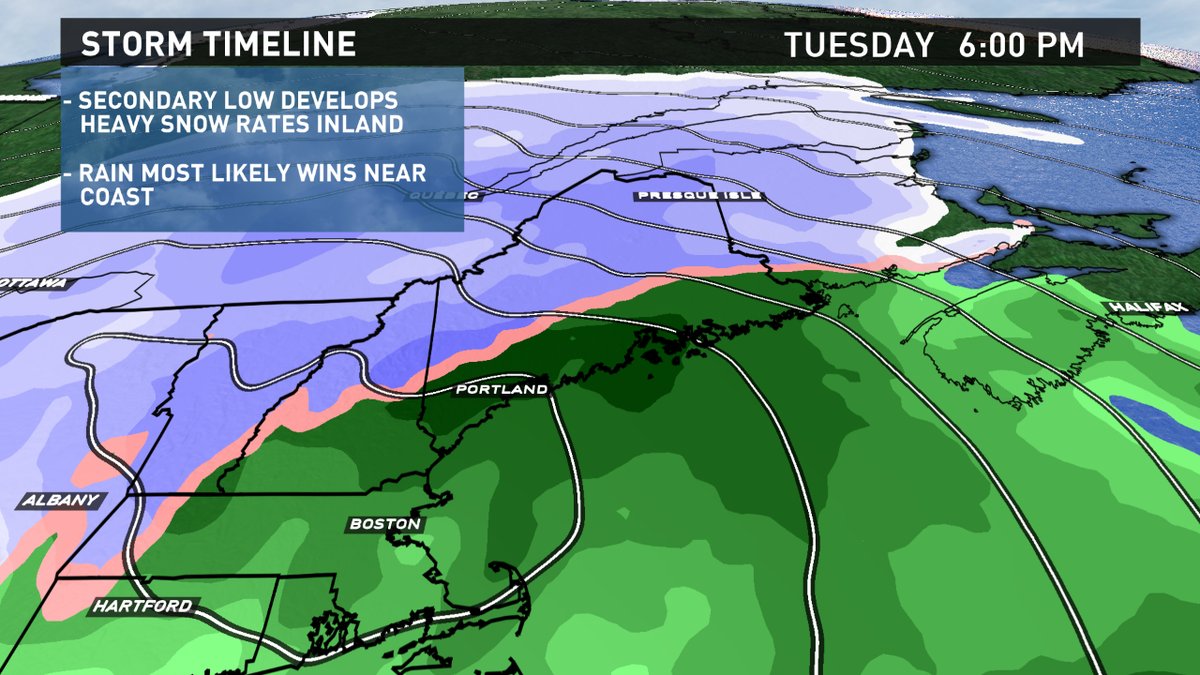
Because of the mixing, amounts are a lot tougher with this storm. The theme will be for the snow jackpot to fall in the foothills and mountains and the lowest amounts near and along the coast.
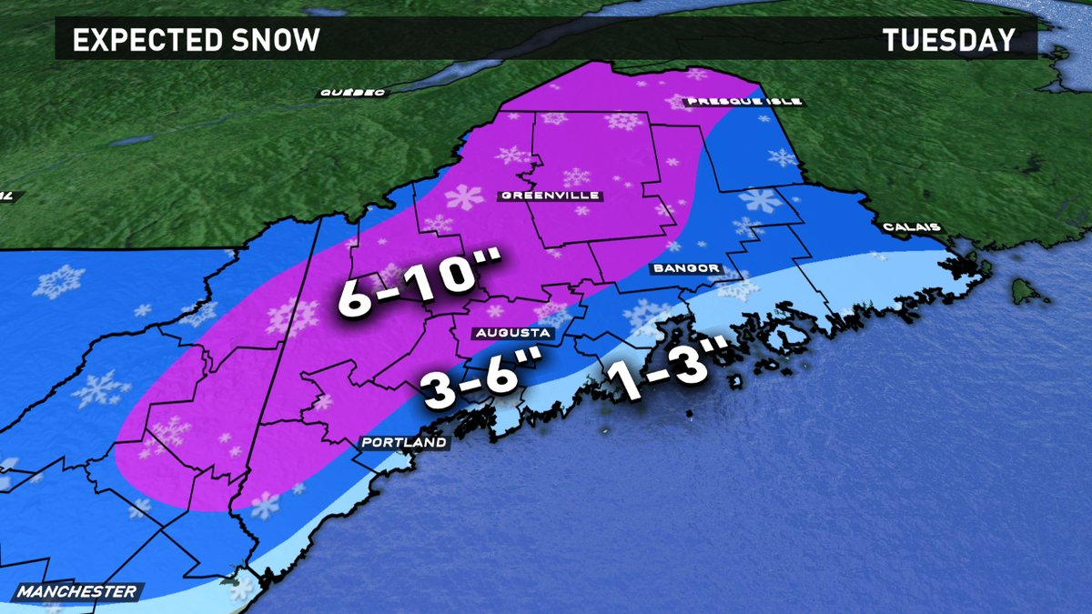
This may be one of those storms where adjustments are made on the fly. The thought as of now is for 1-3" along the coast before the changover. 3-6" inland and 6-10" for the foothills, mountains and north.
Anytime rain falls during the colder season, my guard goes up for ice potential. I see two issues. During the storm, when rain falls, it may fall into subfreezing surface air, know as freezing rain. That may lead to a thin layer of ice on top of any snow. Second, after the storm departs, temps will nosedive and surfaces may ice up late Tuesday night and Wednesday before they get a chance to dry out. Creating slippery conditions during the middle of the week behind the storm system. Please be alert for this.
Follow us through the day and night for any adjustments.
https://twitter.com/ToddWCSH https://www.instagram.com/tgutner/
