We've been telling you the stakes are high with this storm and we were right on the edge of a monster. That edge is even thinner now with the storm jogging west, hitting us a little harder.
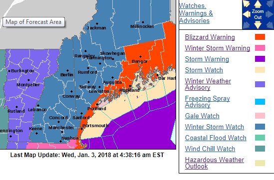
BLIZZARD: When strong winds (at least 35 mph) combine with either falling snow or snow on the ground to reduce visibilities to 1/4 mile or less for at least three hours. Much of Coastal and Eastern Maine is now under a Blizzard Warning, the first of 2018. It goes into effect at noon tomorrow and expires later Thursday night.
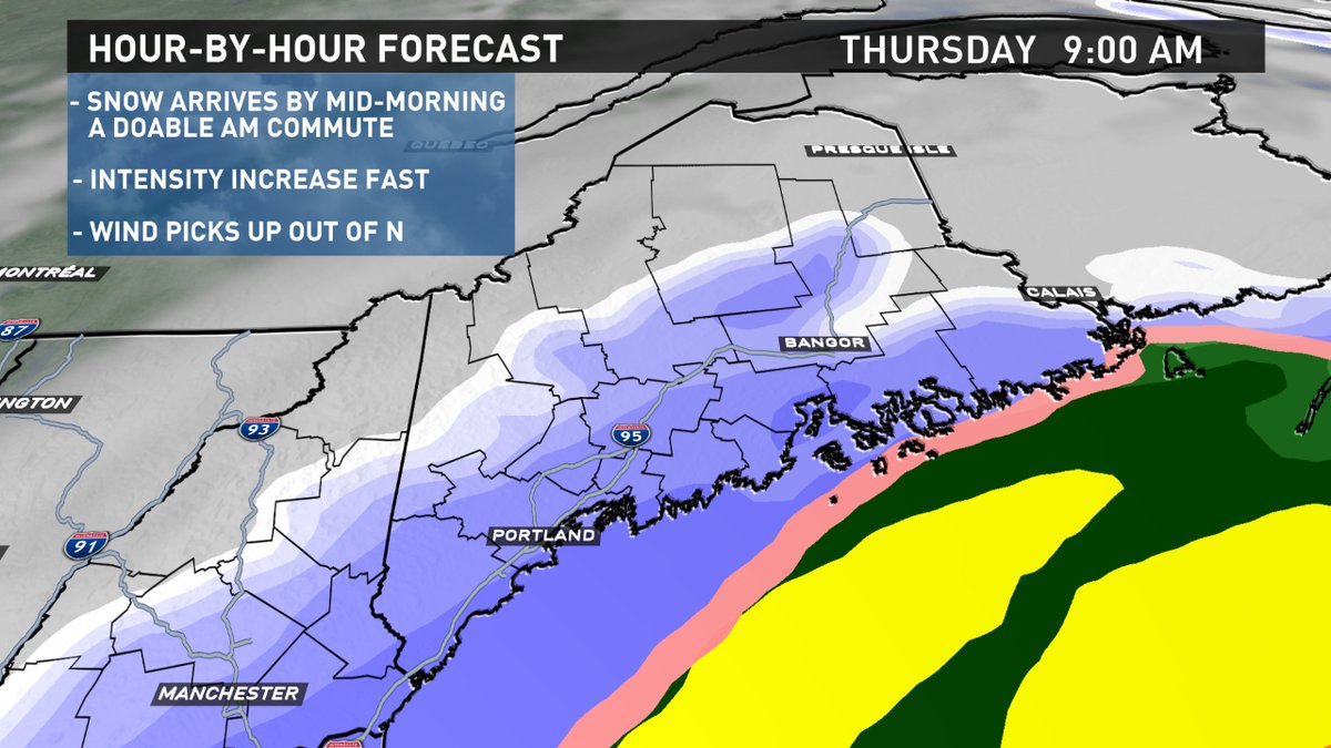
Snow starts around dawn tomorrow morning: between 6-8 AM. While you may get through the commute pretty well, road conditions will deteriorate very quickly.
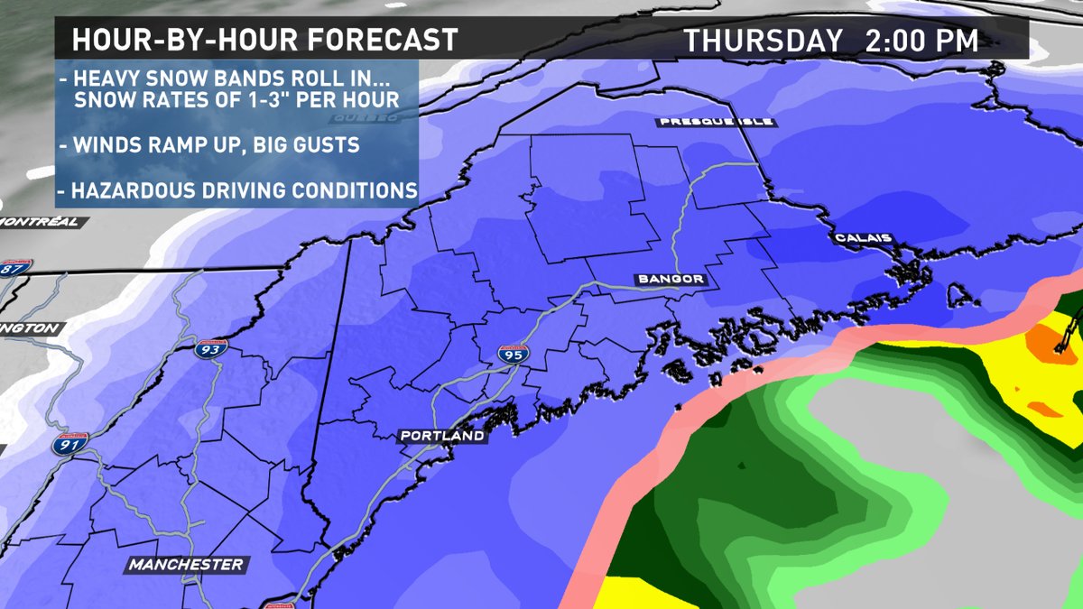
The worst will be Thursday afternoon and evening. Intense snow bands will produce whiteout conditions at times. Winds will really crank too.
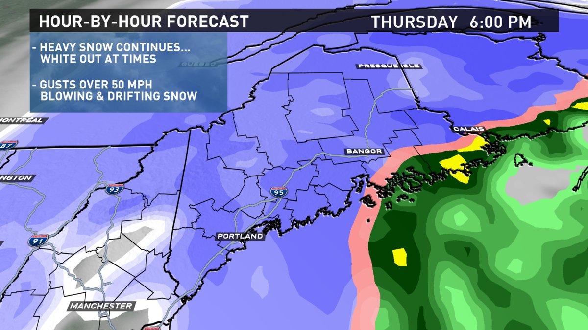
Blowing and drifting will make it very difficult to measure the snow.
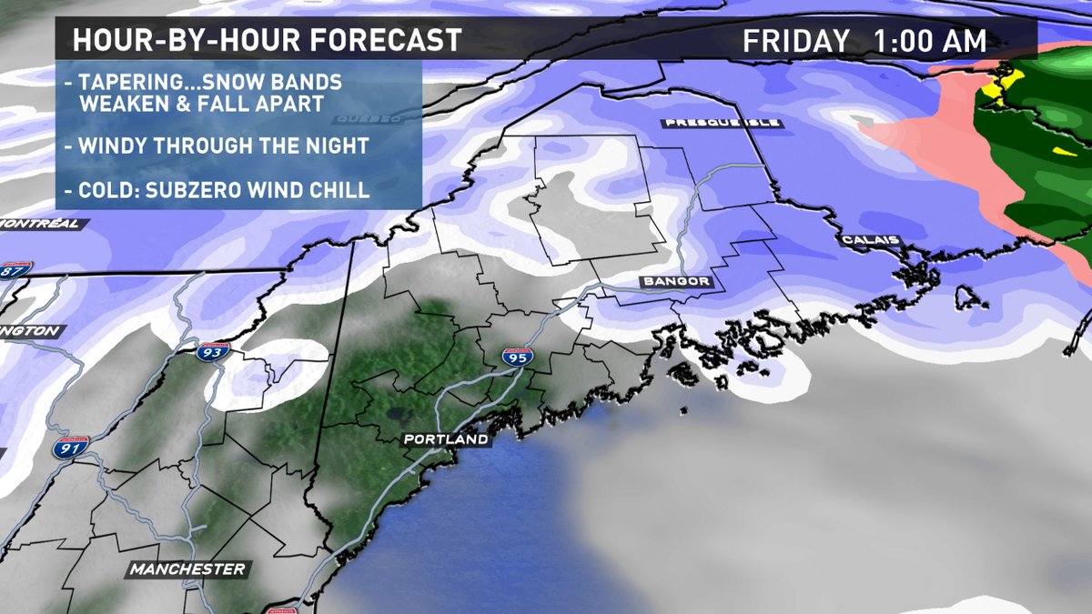
The tapering process begins tomorrow night.
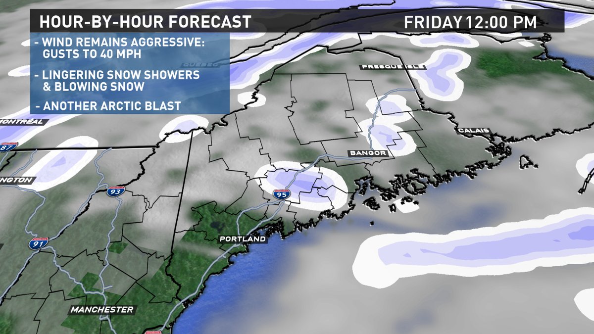
While it may still appear like it's snowing on Friday from the winds, most of the snow will have ended...just lingering snow showers.
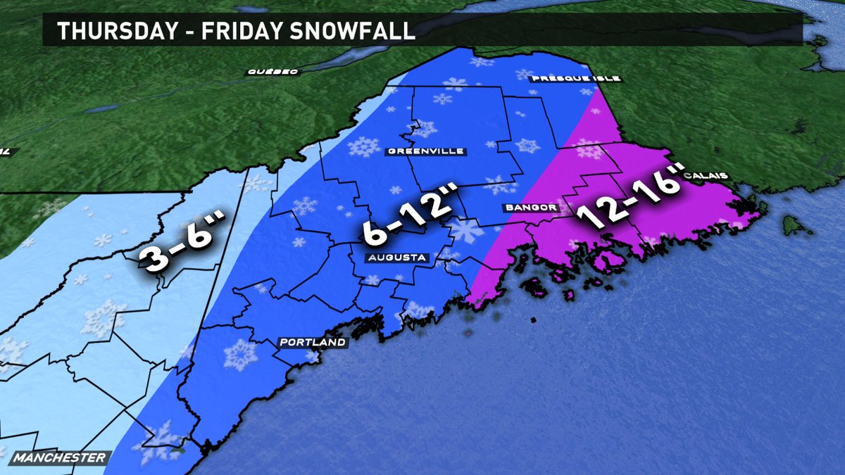
Many in Maine will get double digit, or close to it, snowfall.
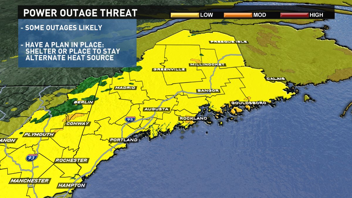
We're Mainers, we can handle a foot of snow, we'll get through that. I'm most concerned with the power outage threat. While it won't be anything like the wind storm back in October, some outages are going to occur. Have a plan in place, just in case. Please, ventilate alternate heating sources well. Run generators outside. Know where your local shelter is too. We'll be here for you through the event with updates.
Todd Gutner - https://twitter.com/ToddWCSH https://www.instagram.com/tgutner/
