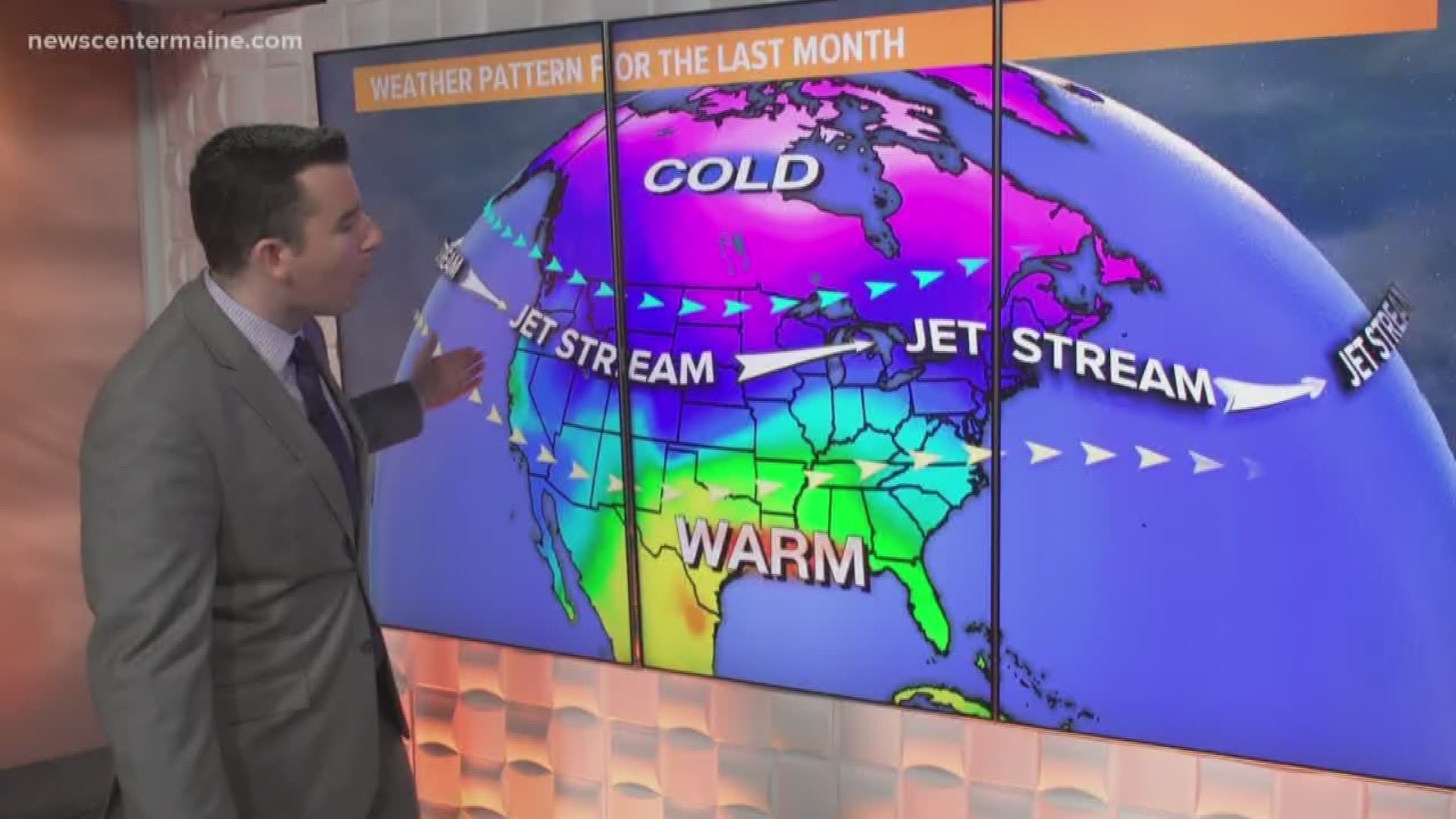
MAINE, USA — The last few weeks have been unusually quiet and warm, relatively speaking.
What makes it even more remarkable? Statistically, the coldest time of the winter is mid to late January; this stretch of warmth started right in the middle of that period.
Remember the "polar vortex"? It's a media buzz word that caught on a few winters ago. But it's a real meteorological phenomenon -- it's basically the upper-level driver of frigid arctic air in the northern hemisphere.
When the polar vortex is strong, the cold air gets locked up in the arctic circle. This has been the case for much of the last month. Alaska has been colder than average too.
When this vortex breaks down and weakens a bit, pieces of arctic air get displaced south. These occurrences typically bring us the coldest air of the winter, but they've been absent lately.
Another connection we look to is the "arctic oscillation".
It's been in the positive phase which promotes a jet stream flow from west to east across the country.
This means our air masses are originating over the Pacific Ocean -- not the Arctic Circle. When our air comes from the Pacific, it's mild. It doesn't cool much while crossing the country.
Its negative phase is the opposite, with big troughs and ridges, often resulting in winter storms and cold air plunging south.

