MAINE, USA — The U.S. Fish and Wildlife Service is exploring the creation of a new national wildlife refuge in the High Peaks area of the western Maine mountains, a proposal aimed at protecting wildlife and preserving access to recreational areas — but also one raising concerns among some area residents.
The agency is studying roughly 200,000 acres straddling the Appalachian Trail, with an eye toward creating a refuge of between 5,000 and 15,000 acres, according to Nancy Perlson, a local conservation consultant working with the Fish and Wildlife Service.
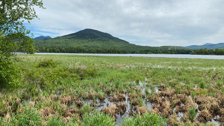
The High Peaks region includes 10 of the 14 highest-elevation peaks in the state and one of the largest expanses of roadless areas in Maine. There are several small towns in the area, including Rangeley, Stratton, Kingfield, Carrabassett Valley, Salem, and Madrid.
“The High Peaks region is of exceptional ecological value, made up of a diverse biogeography that extends from low-lying forests, wetlands, streams, and lakes to high-elevation mountains with alpine vegetation and boreal species,” Sally Stockwell of Maine Audubon said in a statement of support.
Paul Casey, an official with the US Fish and Wildlife Service who is managing the process, said the creation of a national wildlife refuge would extend “a little more opportunity” for conservation and protection of species in the area than the state currently provides. He cited protection of migratory birds and the Atlantic Salmon as two examples.
The federal agency held a series of “scoping sessions” to hear from the public in Rangeley and Farmington in May, and more are expected in the coming weeks in Carrabassett Valley and at the Sugarloaf ski resort.
The next step is to involve other interested parties, including snowmobilers, hunters, ATV users, business owners, and conservation advocates, and then develop a proposal this fall. It would then be open to formal public comment for 45 days.
“We have the ability to craft what this refuge will look like,” Perlson said in an interview.
Casey, the refuge manager at the Umbagog National Wildlife Refuge, said he would expect a proposal to go to the director of the Fish and Wildlife Service by the winter of 2024.
The federal agency considered a similar proposal about ten years ago, but the idea fizzled, and some opposition to the new effort has already surfaced. The Franklin County Commission recently voted 2-0-1 to not support the still-emerging proposal, with one member abstaining. Selectmen in the town of Eustis have also voted to send a letter of opposition to the Fish and Wildlife Service, a town official said.
Bob Carlton, one of the county commissioners, has been an outspoken critic. He said much of the land is already protected by the state and various land trusts, and he doesn’t want an additional layer of federal control.
“Everything’s protected, everything’s fine. It’s not broken,” said Carlton, a veteran forester who stressed that he is speaking out as a private citizen. “The bottom line is we want state control.”
Steve St. Jean, chair of the Eustis select board, echoed a similar concern: “There are 200,000 acres of protected land in (the) area now and everything above 2700 feet needs special permitting to do anything. So adding another layer of protection, especially Federal, seems unnecessary.”
US Rep. Jared Golden, the Democrat whose district includes the area, is keeping an eye on the process.
“Any time the federal government proposes making changes to Maine land, there are questions and the Congressman is currently in the process of gathering answers to those questions,” a spokesperson for Golden’s office said Friday.
A map circulated at the public listening sessions alarmed some area residents because it identified a study area encompassing a large, oval swath of some 200,000 acres. However, the actual size of the refuge would be much smaller, officials said.
The Sugarloaf and Saddleback ski areas are nearby, but would not be part of the proposed refuge, according to Casey.
“The developed areas are not being considered,” he said in an interview. “We’re sensitive to the economic activity here. We’re looking for undeveloped land.”
He said the refuge would not necessarily be made up of contiguous property, but instead could be made up of individual tracts of land whose owners would be “willing sellers.”
“I don’t see this as one consolidated area,” Casey said.
A seller could retain some rights to the land. “Landowners have no obligation to sell their land or otherwise participate in the proposed refuge at any time,” the Fish and Wildlife Service says on its “frequently asked questions” page.
Both Casey and Perlson stressed that the interests of recreational users would be taken into account as the plan evolves. Perlson noted that, with new development coming to the area, the addition of a refuge would actually have the effect of retaining trails and public uses for recreation. (One recent study found the western Maine mountain region lost 12,000 acres to development between 2007 and 2017.)
According to its question and answer page, the wildlife service “supports wildlife-dependent recreation, including hunting, fishing, wildlife observation, wildlife photography, and environmental education and interpretation.” At the Umbagog National Wildlife Refuge, for example, the agency allows “snowmobiling, cross-country skiing, biking, and horseback riding.”
Some other national wildlife refuges in Maine are considerably larger.
For comparison, the Umbagog National Wildlife Refuge, which is in both New Hampshire and Western Maine, is about 37,000 acres. The Moosehorn National Wildlife Refuge in Washington County is just under 30,000 acres.
This story was originally published by The Maine Monitor, a nonprofit and nonpartisan news organization. To get regular coverage from the Monitor, sign up for a free Monitor newsletter here.


