MAINE, USA — There are certain signals I'm willing to ignore. For example, when I cross the newsroom to talk to Amanda and Brian and they promptly put on their headphones, turn to their monitors, and start typing. I'll ignore that signal all day, every day.
But the signal for a big storm next week? That one I can't blow off.
Outside of those awful inside runners we had in December and January, this is the most classic setup I've seen all season. And this time, unlike those aforementioned storms, it has a real chance to be a snow storm... not just a rain/wind storm.
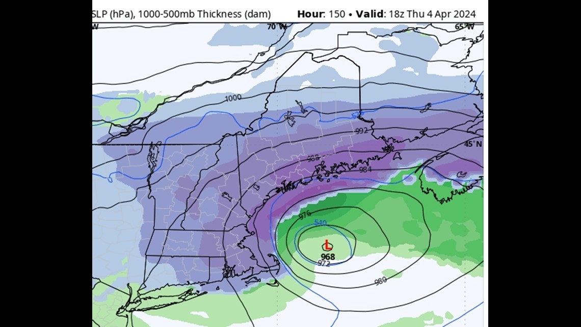
So what has my nerd pants in such a bunch? Basically, seeing this, or something very close to this, in every major model run over the past three days:


I know not everyone speaks weenie, so to summarize — that's a major nor'easter in the perfect spot to give us a lot of snow to kick off April.
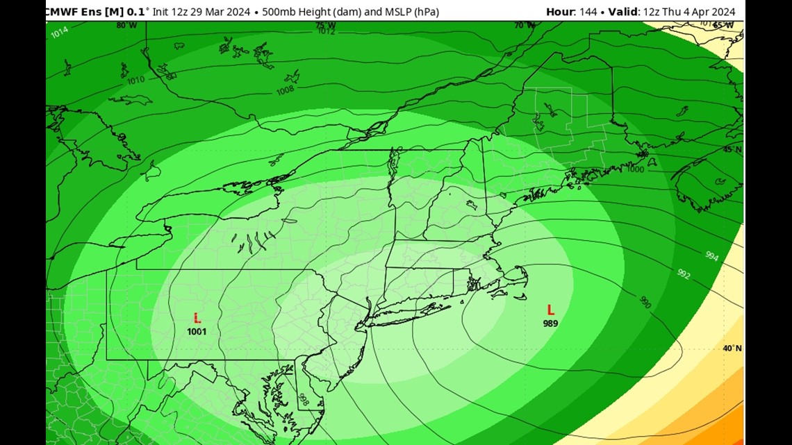
And it's not just the surface-level computer models that look good for snow — the overall "synoptic scale" does, too:


The image above is an "ensemble mean," which is created by running a model over and over again with slight changes in the initial conditions. The resulting forecast tends to do a better job conveying uncertainty and possible alternate scenarios.
So to have a closed-off, deep low-pressure system in a good position on the ensemble is a strong signal for a major storm next week.
Everyone reading this blog so far:
It means that Wednesday and Thursday next week have a fairly high probability of being impacted by a major storm.
Is it rain or is it snow? At this time, it looks like it will start as rain and then cold air will get wrapped in from the low and change everyone over to snow, even the coastline. But that of course is track-dependent. Nothing is a lock five-plus days out, though there have been many more model runs with snow than model runs with rain.
How much snow for my town!? Stop it. You know better. But there is absolutely the possibility of 1 to 2 feet of snow in a good part of the state if the storm sets up just right.
What could ruin this and make it lame? The biggest risk here is that the storm closes off the low too far west. If that happens, the system will be robbed of the dynamics and moisture of the Gulf of Maine and be more annoying than epic (title of my autobiography).
When will we know what to really expect? On Sunday or Monday, we will have a very solid handle on this storm. So... "stay tuned" and all that corporate stuff.
- Carson
Check out my Instagram: You'll see more skin there than in a box of Old Orchard Pier Fries.


