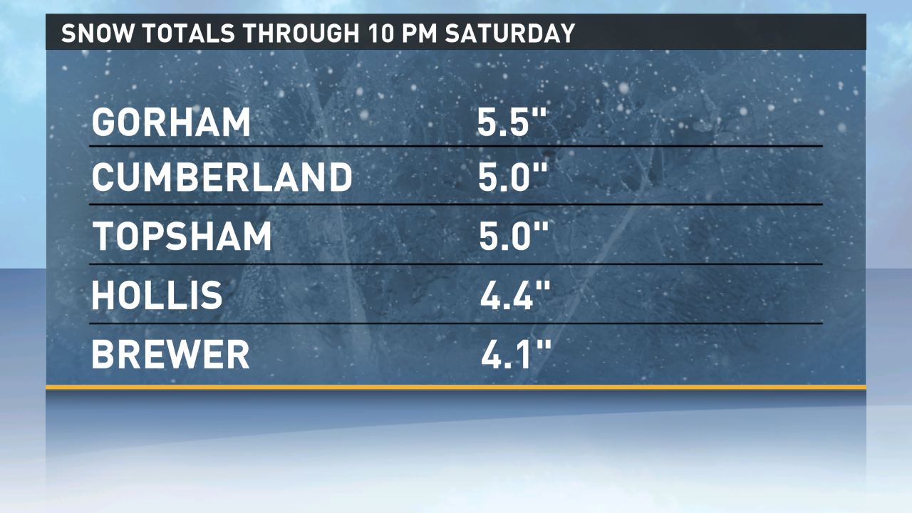
The first snow event of the season is going according to plan. Most areas will receive between 3 and 6 inches of snow. Some towns will see a bit over 6 inches in total. Here are a few totals as of 10 p.m. Saturday:
Accumulating snow will end before dawn in almost all of the state. A few lingering snow showers are possible through mid-morning in far eastern Maine.
The next storm arrives Tuesday. Its origins will be a vigorous clipper system digging into the Great Lakes region Monday night. A secondary area of low pressure will develop once the energy hits the coast, and that's the key to our forecast. How quickly this secondary low develops, and where it tracks, will determine how much snow we see.
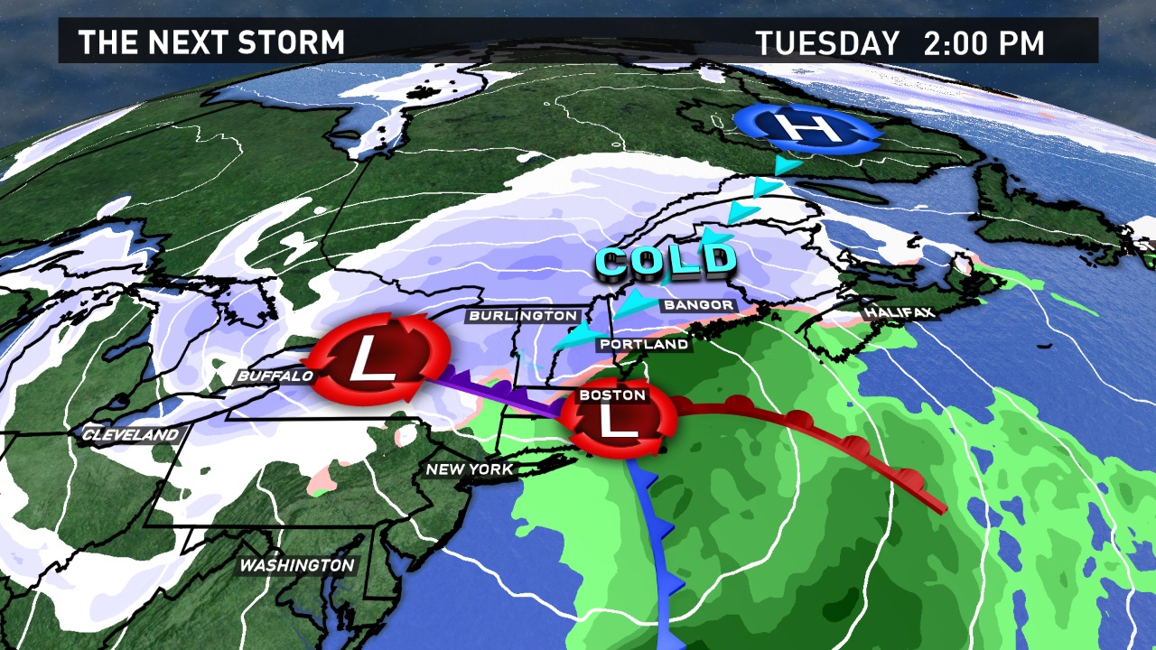
Right now it looks like much of the state will see accumulating snow again Tuesday. Cold air will be tough to budge inland, where snow and a wintry mix is likely. A change to rain (or even freezing rain) is possible in southern and coastal areas. The storm's track should come into much better focus during the day Sunday. Follow our updates on-air and online then.