Harvey will continue to sit and spin over the next few days, dumping buckets of rain in waterlogged, flooded areas of eastern Texas. The Houston area has already picked up nearly two feet of rain.
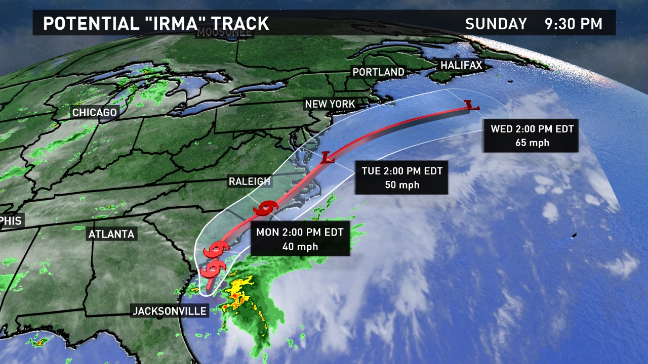
Meanwhile, another tropical system is starting to take shape off the southeast coast. "Irma" is likely to be named early Monday.
It's not expected to become a hurricane, but it will bring gusty winds and heavy rain to the coast of the Carolinas Monday and Tuesday.
Tropical storm watches were issued Sunday for parts of the South Carolina coast and all of the North Carolina coast. This is the first year the National Hurricane Center has issued watches or warnings for tropical systems before they have officially declared them a depression or tropical storm.

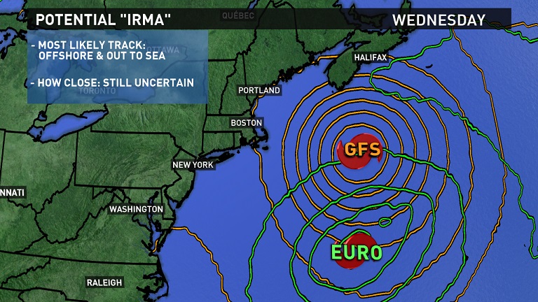
Most available computer models agree Irma will move offshore and out to sea. The National Hurricane Center's preliminary track suggests the same.
However, how close the storm comes to Maine is still in question. As of Sunday evening, two of our more commonly used models (the American GFS vs. the European) have tracks that are nearly 250 miles apart.

While neither come close to bringing rain or wind to us, the northern track would mean a higher impact for mariners and those hitting the beach. High surf and rip currents are likely to become an issue Wednesday and Thursday.
Check in with the weather team for updates Monday, as Irma develops and its track becomes more clear.

