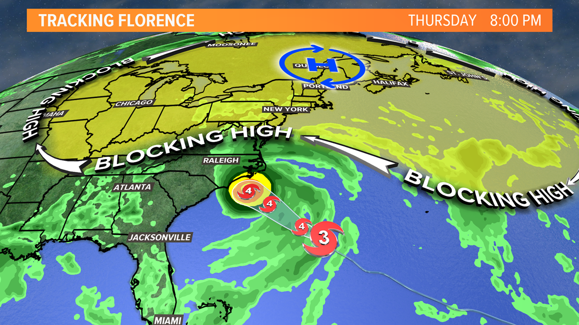
We're a day closer, but not much has changed in Hurricane Florence's forecast track. Hurricane Warnings have been issued for parts of the coasts of South Carolina and North Carolina.


As of Wednesday afternoon, the center of the storm is about 450 miles southeast of Myrtle Beach. It's moving to the northwest at 16 mph, but the storm's forward speed will decrease as it approaches the coast. That's the problem.
Florence will slow down and maybe even stall as it bumps into the blocking ridge of high pressure we've been talking about for days. This will mean virtually zero impact from the storm here in Maine. It will mean over two days of rain, strong winds and storm surge for parts of North Carolina and South Carolina.


Life-threatening, catastrophic flash flooding and significant river flooding is likely over portions of the Carolinas late this week into early next week, as Florence is expected to slow down as it approaches the coast and moves inland.
Damaging hurricane-force winds are likely along portions of the coasts of South Carolina and North Carolina.
In Maine, about the only impact will be some higher surf. A High Surf Advisory has been issued for the coast Thursday. Rip currents and 4 to 6 foot long period swells are possible.


